This moderate trail is a mile long (one-way) with about a 970 elevation change. The trail follows the creek, but is a good ways above it. There are a couple waterfalls along the way, but the views are mostly obscured by trees. This trail is fairly shaded though and does have a couple springs along the way, making it a pleasant short trail to wander up.
 |
| Topographical Map - Blue = Hobb Canyon Red = Bonneville Shoreline Trail Green = Great Western Trail |
 |
| Graph of Elevation |
 |
| Trail in Google Earth |
Finding this trail may be the most difficult part, since it is not marked at all. You have to park on the street below and follow the road to the end of the cul-de-sac to find the trailhead. The first point of interest you will arrive at is a clear spring with water causing the sand at the bottom to dance and bubble up.
 |
| Spring near trailhead |
After a very short distance of about 300 feet from the trailhead and very soon after the spring, a trail turns off and abruptly heads back the direction you came from. It only continues back for a short distance though before heading east up the canyon.
If you miss this turn off, you will come to a gate and then to the creek. The trail does cross the creek, and soon after that there is another turn off the mail trail for the Great Western Trail. We missed the Hobb Canyon Trail and ended up going up the Great Western Trail a little ways before realizing our mistake and backtracking. So, just know if you get to the gate or the creek, you have already gone too far.
 |
| North Fork Kays Creek - if you reach this point, you have gone past the trail |
This trail follows the North Fork Kays Creek, but it is a good ways above the actual creek. You can hear the creek below and there are a few little waterfalls along the trail. Only one of them is very visible through the trees though. The trail also has a pretty good amount of shade along it.
 |
| Waterfall visible from trail |


About 0.4 mile up the trail there is a little spring and a primitive camp area with a fire pit.
 |
| Spring along the trail |
There are also some nice views of the canyon with the valley below along the way.
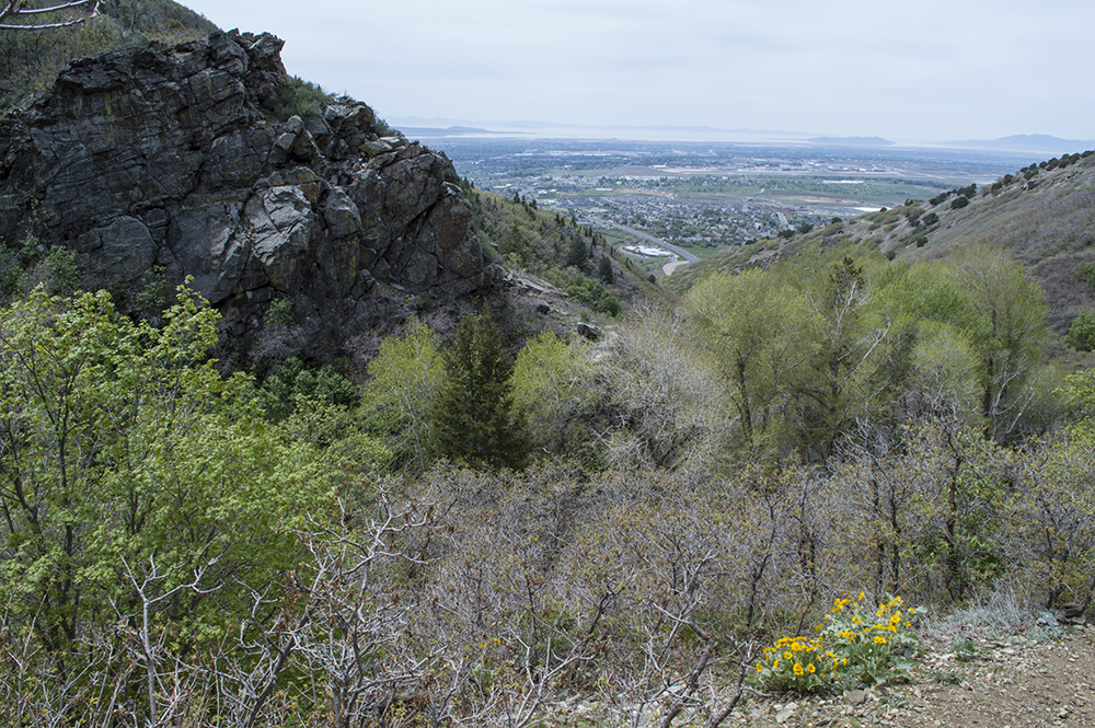 |
| View of the Hobb Canyon with the valley below |
There is nothing significant at the end of this trail; it simply fades out and becomes lost in a group of rocks.
 |
| Trail disappearing into a group of rocks |
This trail is open to pets, but please clean up after them. There are no restroom facilities at the trailhead or along the trail.
Directions
This trail is located in Davis County, Utah in Layton. If coming from the south, take US-89 north to Valley View Drive. Turn right, and then turn left left immediately after to continue north on Valley View Drive. As you contineu up this road it will become Layton Ridge Dr. Park in the parking area up this road, and then walk up it to the end of the Shoreline Cir. cud-de-sac to find the trailhead.
If coming from the north, you can take Exit 334 off of I-15 for 700 North/UT-193. Head east along this road until it intersects with US-89. Head south on US-89 a short ways until you read Valley View Drive, and then continue as explained above. GPS coordinates: N41 06.454 W111 54.257