The Trail
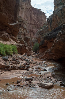
This moderate route heads straight through Sulphur Creek as it winds through the bottom of a 600 foot deep gorge. It has some slightly more technical sections that require rock scrambling. However, the obstacles are not difficult to get past, especially for experienced hikers. It is about 6 miles long (one-way) with a 511 foot elevation change. It is usually started from Chimney Rock and ended at the Capitol Reef Visitor's Center. Note that you will need to plan a shuttle car to do it this way though unless you plan to walk back along the road three miles to you car. The water levels of Sulphur Creek can vary a lot, and there is flash flood danger here as this route travels through a slot canyon, so make sure you check what conditions are before you start. The Visitor's Center should be able to provide this information. Sometimes the water can be deep enough to require swimming, while at other times you can easily walk through it without getting your shirt wet. It was just over knee deep when we went at the beginning of August.
You can also check the water levels yourself by walking to Sulphur Creek right behind the Visitor's Center. If the water here is about ankle deep, then the trail should be okay for older children. If it is deeper than that, it is probably not a good time to go with kids.
 |
| Topographical Map |
 |
| Graph of Elevation |
 |
| Trail in Google Earth |
Note that the information in the maps and graph above may have a number of discrepancies in them since the GPS is frequently thrown off in slot canyons.
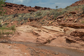
The trail starts directly across the street from the Chimney Rock Trailhead parking. A sign here reads "Visitor Center Via Sulphur Creek 5." Follow the path a short ways to the bottom of a wash, and head south. Continue along the wash for about 1.5 miles until it joins up with Sulphur Creek. As you go, the canyon will gradually grow taller
The wash is usually fairly dry, and the only obstacles along the way are a couple of small dry falls that can be easy climbed down. If you find these particularly challenging though, you may want to reconsider continuing as the climbs to follow are trickier.
 |
| Dry Falls in the Wash |
The canyon walls become dramatically steeper after hikers start east along Sulphur Creek, which winds in U-shaped curves through the canyon. This section is known as the Goosenecks, and can be viewed from above at the Goosenecks Overlook. Depending on water levels and your jumping skills, it is possible to keep your feet dry still throughout this section of the route.
The first waterfall is found about 3 miles from the trailhead. It can be bypassed by walking along the ledge on the right and then climbing down about 10 feet at its end. This climb is made fairly easy by the many grooves in the rock here. Depending on water levels, you could end up climbing down into the water or onto a small sandy bank, but either way you will have to trudge through the water after this point. Still, it is recommended you don footwear with good traction and not cheap sandals to make climbing on the rocks easier.
 |
| Ledge to the right of the first waterfall |
 |
| First Waterfall |
This portion of the canyon is particularly scenic. In about another tenth of a mile, hikers will arrive at the second waterfall.
 |
| Top of Second Waterfall |
This waterfall can also be bypassed by going around to its right, under a large rock, and climbing carefully down the rocks here.
 |
| Passage around the second waterfall |
 |
| The Second Waterfall |
The scenic narrows continue for awhile after this before opening up more. Little cascades of water dot the creek and add additional interest as you continue down.
The last waterfall is about 4.8 miles down the trail. While we read that it can be bypassed by heading up ledges to the right before reaching its drop off, we were unable to find an easy route this way. We found it easier to step over the falls and skirt the ledge to the left of the falls before climbing down into the pool below.
 |
| Hikers climbing down the ledge to the left of the last waterfall |
 |
| The Third Waterfall |
From here the route is even more open. Following the creek, it is about another 1.1 miles to the Visitor's Center from the last waterfall. As you near the Visitor's Center, you will see some nice views of The Castle in the distance.
 |
| The Castle |
Many people who don't want to go down the entire canyon can also just follow the creek to the last waterfall from the Visitor's Center.
There are bathrooms available at the Visitor's Center and outhouses at the Chimney Rock Trailhead.
Directions
This trail is located in Capitol Reef National Park in Wayne County, Utah near Torrey. To get there, take UT-24 to Capitol Reef. Get off at the trailhead for Chimney Rock, which is just off to the north along the highway, between 7 and 8 miles from the middle of Torrey. GPS Coordinates: N38° 18.950' W111° 18.238'


No comments:
Post a Comment