The Trial
This strenuous trail is about 7.6 miles long (one-way) with about a 4,660 foot elevation change. This trail heads up the Giant Staircase, which consists of five giant steps that were carved out by glaciers, before connecting with the Aspen Grove Trail and ascending to the peak.
 |
| Topographical Map |
 |
| Zoomed-In Topographical Map of first part of trail |
 |
| Zoomed-In Topographical Map of second part of trail |
 |
| Graph of Elevation |
 |
| Trail in Google Earth |
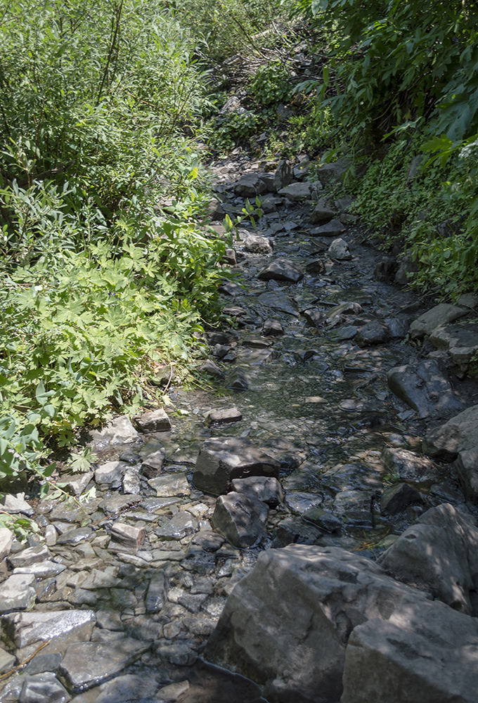
This trail is easy to find and begins directly south of the parking area. It begins with a mild climb through a pleasant forested area that gradually steepens. As hikers near the turn-off for Scout Falls (indicated by the blue path in the maps above), there are wet sections of the trail where shallow water runs over the path. The turn-off for Scout Falls is 1.5 miles from the trailhead and comes at the end of a switchback.
 |
| Shallow water along the trail |
 |
Small waterfall seen from trail. The water from
this crosses the trail where I am standing. |
Soon after passing Scout Falls, the trail reaches the Middle Basin, where the trail flattens out for a bit before continuing its ascent. The trail continues southeast for a ways before turn west again to climb up a step of the Giant Staircase. It then hits a rocky open section of scree, levels off briefly, and turns southeast again.
 |
| Middle Basin |
 |
| Scree section of trail |
Around five miles up the trail hikers will arrive at Upper Timpanogos Basin. At this point there is a sign that says "Toilet" at a trail intersection. This side trail to the right (in green on the maps above) no longer leads to a usable toilet, though it did when I first completed this hike a couple decades ago. Over time, the toilet became a filthy dilapidated thing, and I don't believe it is there at all now. This is a true shame since there are no other bathroom facilities up this way, and many people go in the bunches of trees without bothering to follow proper wilderness protocol and pack out whatever they bring in and/or to bury feces. It is my understanding that the Forest Service decided to discontinue providing or maintaining any sort of toilet facility since this area has been declared a "wilderness" area, though it would probably stay in better shape and be cleaner if something along those lines was actually provided.
The trail that is labeled "Toilet" does however lead to the World War II Bomber wreckage about a mile off the trail, as
explained in part here.
Not long after the "Toilet" intersection is another intersection (marked by the blue flag in the topographical maps above). As clearly indicated by the wooden sign here, Trail 0.52 will take you to the Aspen Grove Trail and Emerald Lake. To continue straight to the summit, continue left along Trail 0.54 as marked.

If you plan to do this hike in a single day, I believe the best way to approach it is by starting early in the morning. I have started at different times, but really believe that starting early like this makes the hike feel much more manageable. Depending on your hiking speed, it is good to start anywhere from midnight to about 2:00 a.m. and hike up in the dark. You can watch the sunrise this way from the saddle or from the top. Hiking up in the dark makes it much cooler (dress appropriately as it is cold at the top in any case), and it leaves the top and distance difficult to discern on your way up. In my opinion, this makes it easier to just keep going without thinking about how much further you still have ahead. When I went this time around, some members of the group were slower than planned due to unexpected challenges, and therefore we found ourselves in the Upper Timpanogos Basin at the time of sunrise. It was still beautiful from there.
 |
| Sunrise |
After making your way through the basin, the trail switchbacks up to the saddle. There is another trail (marked by the hiker symbol) that intersects along these switchbacks where the Aspen Grove Trail meets up with the Timpooneke Trail. This trail also heads to Emerald Lake and is the more direct route to the summit from the Aspen Grove Trail. It traverses the rocky slopes beneath the top of Mount Timpanogos and is often partially covered with snow. Not far from this intersection is the saddle from which views of Utah Valley open up.
 |
| Trail coming from Aspen Grove |
 |
Looking up at the saddle and peak. Note the trail to the left; this is the trail
from Aspen Grove |
|
 |
| Looking toward Mahogany Mountain from the saddle |
 |
| Looking at Timpanogos Basin and Roberts Horn from the saddle |
From the saddle, the trail cuts to the west side of the ridge and climbs up to the peak from that side of the mountain. This section of the trail has a number of steep rocky parts that may require some slight scrambling.
 |
| Looking back toward the saddle |
 |
There are steep rocky sections along this part of the trail. This is looking up
at the trail as it zig-zags up a steep section |
 |
Same section as the picture above looking down
from the top of it |
 |
Wildflowers will still grow and bloom amid the rocks along this
last part of the trail |
 |
| Looking toward the peak |
There is a odd metal hut structure at the top. This structure was originally built by surveyors who used the peak as a triangulation point for their measurements. The circular peak marker and summit log are inside of this hut.
 |
| Metal hut on top of Timpanogos |
The views from the top are expansive especially on a clear day. It could have been more clear while we were there, but it was still fantastic.
 |
Looking down at Emerald Lake from the top. The lake in the background
is Deer Creek Reservoir |
 |
Looking back at the trail up from the top. Bomber Peak is the farthest right
along the ridge line in the photo. |
A trail also appears to continue south along the ridge (partially shown in brown in the maps above). This is the way hikers go who wish to slide or hike down the glacier to get down to Emerald Lake. Sliding down is sketchy and is not recommended; many people have been injured going this way.
 |
| View/trail looking south of the peak |
The safer route is to hike back down the way you came up. With the sun now up, we enjoyed the breathtaking display of color on our way down through the basin. While I have hiked this trail several times before, this was the best I had ever seen the wildflowers. The kaleidoscope of color was a brilliant masterpiece of nature well worth the effort of the hike in and of itself.
 |
Looking toward Robert's Horn
|
 |
Shrubby Cinquefoil surrounded by lots of other
wildflowers |
 |
Looking up at the glacier, which is the section that
some people slide down. |
 |
| Upper end of the valley right below Upper Timpanogos Basin |
Continue down the way you came. If you have the time and energy, Scout Falls is a nice stop and pleasant place to cool off on the way back down.

There is a fee required to access this area. As mentioned previously, there are no restroom facilities along the trail, but there are vault toilets at the trailhead. Please be mindful to pack out whatever you pack into the area and stay on the trail to help prevent erosion and other damage to the area. Make sure you are well prepared with the proper supplies and clothing before you leave; many people have ended up injured or dead hiking this mountain who were not adequately prepared or wise during their adventure. Horseback riding is permitted, but not all the way to the top of the trail. Dogs are permitted on this trail, but should be leashed. This is as much for their safety as for anything else; I have heard and read of a number of people who had their dogs gored by mountain goats. In fact, seeing mountain goats along this trail is normal; I have seen them there every time I have gone. They don't seem that worried about the people any more either; this last time I came within six feet of a mother and her baby in the dark before I realized they were there and they didn't seem too concerned. You should definitely respect these animals though and maintain some distance from them. You may also encounter moose or see some big horn sheep.
 |
| Mountain goats grazing at the saddle near a fair number of hikers there |
 |
| Mountain goat watching us descend the mountain |
Directions
This trail is located in Utah County near Alpine and Cedar Hills. To get to there from I-15, take Exit 184 and head east on Timpanogos Highway/UT-92. You will continue up this road into American Fork Canyon. Beware that there is a fee to go up the canyon and use this area. Continue up this road following signs for the Timpooneke Campground. The trailhead parking will be on your left just before the road reaches the campground. Make sure to take the trail heading south since a couple trails start from this area. GPS Coordnates: N40° 25.884' W111° 38.332'