June 29, 2020

Kays Creek Parkway Loop Around Hobbs Reservior

The Trail
This easy trail is about three miles long from the Kays Creek Trail parking area off 2125 East so long as you stay on the blue loop shown below. However, there are a number of possible access points to this trail and the length could vary widely based on where you start and stop.

Topographical Map (blue = loop; green = path over dam;
red = path to neighborhood)

Graph of Elevation

Trail in Google Earth

The Kays Creek Parkway Trail is a popular paved trail used widely for walks and exercising. If you start from the parking area, the trail will be pretty flat until it ascends up the hill to the dam. The paved trail splits about 0.3 miles up from the parking area. We completed this loop going clockwise, so we went left here.

Trailhead at parking area

Trial Split
If heading clockwise from here, the paved trail continues around the north side of Hobbs Reservoir, crosses a bridge at the northeast side, and loops around. The paved path continues, but dead-ends along this east side with a dirt path heading up to a neighborhood.

However, just before the dead-end, another dirt path partially obscured by the trees heads down with some steps. This is also next to a green metal warning post. The path from here back to the dam is a dirt trail (the path between the two green dots on the topographical map above).

Dirt path heading down from paved portion of the trail

Steps heading down the dirt path

This portion of the trail is much rougher than the paved path, with short sections of up and down. Parts of the path are slick packed dirt, so use some caution if you don't have good tread on your shoes. However, overall there is minimal elevation change and the trail is otherwise easy and straightforward to follow.


Most of the trail follows the reservoir fairly closely and is surrounded by water loving vegetation. However, part of the trail rises further above the reservoir and is surrounded by dry climate vegetation, including prickly pears.


While we were there, we found that a group must have painted rocks to leave along the trail for hikers to enjoy. Our kids really enjoyed trying to find as many of these rocks as possible with their uplifting messages and bright pictures. We doubt these rocks will always be there, but they are fun to find so long as they are.


Not too far from the dam there is a boat ramp (labeled with a symbol on the topographical map above). However, be aware that posted signs forbid swimming in the reservoir. The trail reaches the dam again not far from this, and an opening in the fence here at the southwest end of the reservoir leads back onto the paved trail. Head west along this paved trail to complete the loop and return to the parking area.

Sign and path coming from south side of reservoir by the dam

This trail is open to dogs. There are no restrooms along the trail or at the trailhead.

Directions:
This trail is located in Layton, which is in Davis County, Utah. To get there from I-15, take Exit 334 and follow UT-193 east for about 4.4 miles to 2000 East. Turn right here, then turn left onto Deere View Dr. Take the second right onto 2125 East and continue down the hill to the end of the road where there is parking area. The trail starts from here.

Alternatively, depending on the place and direction you are coming from, it may be faster to take US-89. If you go this way, take Exit 404 and head west on UT-193 toward Hill Airforce Base. You will reach 2000 East about a mile after turning off US-89. Turn left here and follow the rest of the directions above.

GPS Coordinates: N41° 05.868' W111° 55.674'

June 08, 2020

Squaw Peak

The Trail
This moderate trail is about 3.8 miles long with around a 2,700 foot elevation change. With its decent climb and beautiful varied scenery, it has long been a personal favorite of mine.

Topographical Map

Graph of Elevation

Trail in Google Earth

This trail starts at the Rock Canyon Trailhead. The first part of the trail follows a paved road, although there are also side trails that are dirt that meet up with the road later. The road is easiest to follow, as the dirt trail intersects with other paths and can be a bit confusing sometimes.

Trailhead

As the canyon narrows, the path goes around a green gate. Then about a mile up the trail, the path crosses a wooden bridge with a number 1 in the left corner (marked with a red flag in the topographical map). There are a few more bridges to cross as the path follows the stream up the canyon before hikers reach an intersection about 1.7 miles from the trailhead. Heading right (shown in red in the maps above) will take hikers up to the campground and to other possible trails and destinations, such as to Cascade Saddle.


First Bridge

Another bridge


The trail to Squaw Peak is marked with a rock, but the lettering on it labeling this path is faded and easy to miss if you aren't paying attention or looking for it.

Intersection for Squaw Peak


Rock with faded label marking path to Squaw Peak

The trail heads up more steeply after this intersection, leading hikers through a pleasant umbrageous forested area.


Wild currents growing along trail

As the trail gets closer to the ridge, it begins to cross small open meadows.


After coming up to the ridge, the trail opens up and hikers can catch some views of Mount Timpanogos to the north and Freedom Peak to the southeast. The trail heads back behind the ridge line again and circles around to climb to the peak.

The impressive view from the peak is definitely rewarding. To the west below the nearly 3000 foot sheer plummet to the valley floor, Utah Valley stretches out in a great yawning expanse before viewers. Y mountain sits directly south, and off to the north rests Mount Timpanogos.

The corner of Y Mountain and a portion of the view of Utah Valley

Mount Timpanogos to the north

I particularly enjoy the views to the east of Shingle Mill, Freedom, and Provo Peaks jutting up above Rock Canyon and the other surrounding valleys.

View of Peaks to the east

After soaking in the panoramic scene, you can head back down the way you came. As you make your way down Rock Canyon be sure to appreciate Squaw Peak perched above you...the high point you just came down from.

View of Squaw Peak from Rock Canyon
Dogs are permitted on this trail. There are restrooms at the trailhead. There is a continuously running water fountain 0.9 mile up the trail (and another one after the turn-off for Squaw Peak) marked with the faucet symbol in the topographical map.

Directions
This trail is located in Utah County near Provo, Utah. To get to the trail head at Rock Canyon, take exit 269 off I-15 for University Parkway. Head east along University Parkway to 900 East. Turn left at 900 East, go to Temple View Drive, and turn right. Then turn right at 2300 North. When the road turns off to the right, stay straight to enter the parking area for the Rock Canyon Trail. GPS coordinates: N40° 15.878' W111° 37.790'

May 17, 2020

Parrish Creek Trail

The Trail
This moderate trail is about 2 miles one way with a 1700 foot elevation change with potential to go much further than that if desired. This trail is used to climb up to Bountiful Peak, but we didn't go that far; we just went a little past the overlook.

Topographical Map


Graph of Elevation

Trail in Google Earth

This trail starts at a dirt parking lot and heads up the hillside, maintaining a steady moderate incline all the way up the mountain face to the ridge. It crosses the Bonneville Shoreline Trail about a tenth of a mile up from the trailhead, but continues straight. (Turning left at this junction could take you to the Parrish Creek Pictographs though, if you want to visit those sometime.)


Despite the trail's name, it does not come close to the creek below and offers only a few distant views of it during the ascent up.

View of distant creek below

When we did this hike at this time of year, the wildflowers were stunning!

Arrowleaf Balsamroot and Penstemons


At one point you will cross a relatively flat grassy meadow.

Looking down at meadow

About 1.8 miles up the trail there is a split. Heading left keeps hikers along the main trail route, while going right leads to a rocky overlook (marked with the camera in the topographical map above).

View from overlook

The overlook makes a nice destination point, but if you would like to go further, a rougher trail connects back to the main trail and goes on. The trail will continue heading east along the ridge line and meeting up with Skyline Drive, which can then be followed to Bountiful Peak if desired. We continued until we hit some clusters of trees before heading back the way we had come.


There are no restrooms at the trailhead. Livestock and dogs are permitted on this trail.


Directions
This trail starts in Centerville, which is located in Davis County, UT. To get there, take I-15 to Parrish Ln in Centerville, getting off at Exit 319. Turn east toward the mountains and continue up 400 N. Turn left at the end of this road right as it curves around to become 700 E. At the end of this road you will find a large dirt parking area. The trail starts just north of this parking. GPS coordinates: N40 55.357 W111 51.981

November 18, 2019

Golden Wall Loop Trail

The Trail
This moderate trail is about a 5.1 mile long loop with a 730 foot elevation change. Keep in mind though that there are a lot of up and down sections within the trail, so the total climb will be greater than this.

Topographical Map

Graph of Elevation

Trail in Google Earth
We started this loop from the Visitor's Center, crossed the street, and went in a clockwise direction around the trail, so that is what is reflected in the information in this post. However, having done it this way, we think it may be easier to follow if you actually go the other direction. There is a parking area on the south side of the road just west of the Visitor's Center that is a great place to park and start from either way even though that is also not where we started.

Starting from where we did, we headed east along the bike path to the campground. The campground was closed on the day we were there, and we ended up passing it then cutting back down to it from the bike path at the far east end of the campground. Instead of doing this, you should just enter in at the campground entrance and find the trail at the west side of the most southern loop. The trailhead is found after the group area between campsites 24 and 26. The trail immediately starts climbing and ascends some switchbacks up a rather bare hill at this point.

Trailhead in campground between campsites

Switchbacks up barren hill

About 0.8 mile up from the trailhead in the campground (and 1.7 miles from the visitor's center parking where we started) there is a split. Heading west along the ridge will take hikers to up the Buckhorn Trail to a nice viewpoint. This trail is shown in red on the maps above. Just heading up to Buckhorn Point and then back to the trailhead makes for a nice shorter trail option that would only be a couple miles long round trip. For those doing the Golden Wall Trail, going this way as a side trip will add about 0.4 mile to your hike.

Buckhorn Trail

Buckhorn Point/End of Buckhorn Trail


Interesting Rock Formation as seen from Buckhorn Trail

View from end of Buckhorn Trail

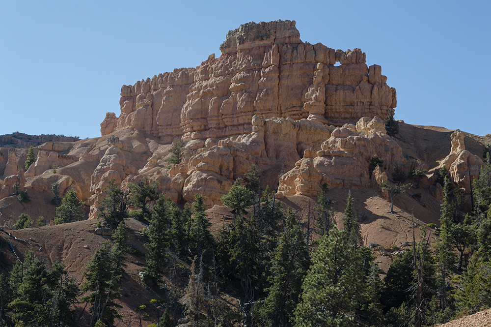
The views after the Buckhorn trail continue to get better along the Golden Wall Trail. There are all sorts of hoodoos right along the trail and great views of colorful sculpted rock walls.


In one spot there are some wooden "steps" hammered into a steeper section of the hillside.


Some of the hoodoos appear particularly precarious and fragile.


About 1.8 miles from the trailhead in the campground (and about 2.7 miles from where we started), the path descends into a wash, as marked by the green dot in the topographical map at the top of the post. The trail turns back out of the wash nearly immediately after that, but we missed this turn and continued up the wash for a ways before we realized we were off the main trail and found our way back up to it (our path is shown in dark green in the maps at the top of this post). The trail going the opposite direction is a bit easier to follow in this section since it is clearly labeled.

Turn back out of the wash if you go clockwise for this loop as we did

Turn out of the wash if you are headed in a counter-clockwise direction -
notice wooden sign marking the trail as it comes out of the wash


About a mile after the wash, the trail splits again at the Castle Bridge Trail. Either fork taken here will bring you back to Hwy 12, but we choose to go right/east. Both ways appear to be similar in length. After hiking another 0.6 mile, the trail will join up with the other side again and continue north back toward the road. These points where the Castle Bridge Trail loop meets are marked by blue flags on the topographical map at the top of this post. The Castle Bridge trail is also a great shorter trail option to go up from the trailhead, complete the loop, and return for about a 1.8 mile long trail.

View from Castle Bridge Trail


Directions:
This trail is located fairly close to Panguitch, Utah. It is also close to Bryce National Park and is an easy stop to make on your way there if you are approaching the park from the west side. To get there from Northern Utah, take Exit 95 and head east on UT-20. From there, turn right/south on US-89 and continue south to Panguitch. Turn left on Center Street in Panguitch to stay on US-89, and then turn left/east onto UT-12. Continue for about 3.3 miles until you reach the visitor's center on your left (where we started from) or the parking area just before the visitor's center on your right.

If you are coming from the Cedar City area, take UT-14 to US-89 and turn left/north. Continue past Hatch and then turn right onto UT-12 and continue for about 3.3 miles until you reach the visitor's center on your left or the parking area just before the visitor's center on your right. GPS Coordinates: N37° 44.748' W112° 19.155'