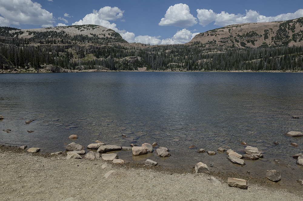
The Trail
This moderate loop trail is about 5.7 miles long round trip with a 440 foot elevation change. However, keep in mind that there are up and down sections within the trail that make the overall amount of climbing greater than 440 feet. This beautiful well maintained trail takes hikers past ten named mountain lakes plus some smaller unnamed lakes. Additionally, this trail connects with other paths giving possible access to other nearby lakes. We did this trail in a clockwise direction, so that is how the elevation information is presented graph below.
 |
| Topographical Map |
 |
| Graph of Elevation |
 |
| Trail in Google Earth (orange trail to overflow parking) |
Please note that the parking lot for this area usually fills up very quickly. If you don't get there soon enough to claim a convenient spot near the trailhead and if you aren't already staying at the nearby campground, you will need to park in the overflow parking area down a ways along the side of the road. There is a trail that goes past Washington Lake and up to the Crystal Lake parking area that is 0.7 a mile long (one-way). This is more scenic than walking back up along the road. Just look for the labeled turn-off for the trail on your left just past the creek and before the road heading up to the parking area.
 |
| Extended Topographical Map (red = loop trail; blue = overflow parking trail) |
If you do start from the overflow parking, the first lake you will see is Washington Lake.
 |
| Washington Lake |
You will also pass the Washington Lake Campground before reaching the parking area. The trail starts on the north side of the lot. To go clockwise as we did, start on the trail labeled Lakes Country Trail 216 heading for Clyde Lake and Long Lake. (If you wish to go counter-clockwise, head up the trail on west side of the parking area toward Wall Lake.)
 |
| Trailhead |
After going 0.3 a mile, the trail will split. Head right along the trail with the corroded label for Cliff Lake. Keeping straight will take you to Long Lake.
 |
| Turn off for the loop trail toward Cliff Lake |
After continuing another 0.4 a mile, you will be at the south end of Cliff Lake.
 |
| Cliff Lake from south side |
 |
| This trail has sections of boardwalk that keep your feet dry |
 |
| Cliff Lake from north side |
About one mile up the trail hikers will arrive at Petite Lake. Next will be the very small Linear Lake, and then will come Watson Lake. Watson Lake is aptly named for the fact it is nestled right below Mount Watson.
 |
| Petite Lake |
 |
| Watson Lake with Mount Watson behind it |
After Watson Lake, the next large lake is Clyde Lake. This section of the trail includes the largest ascent of the loop, but it is still relatively quite mild.
However, before reaching Clyde Lake, 1.8 miles up from the trailhead there is an unmarked and unofficial trail to the right leading out to an unnamed lake. Heading this direction is well worth the short side trip; the view from here is phenomenal. This was probably my favorite spot along the entire trail. A small lake lies just below a shallow cliff. A small alcove hides under the cliff to the north, and to the south the view expands to include Wall Lake below with Notch Mountain, Reid Peak, Bald Mountain, and Murdock Mountain resting in the background.
 |
| Small unnamed lake off the main trail |
 |
View from the unnamed lake. Mountains in background left to right: Notch
Mountain, Reid Peak, Bald Mountain, Murdock Mountain, Mount Cardwell |
The much larger Clyde Lake is roughly two miles up from the trailhead. We ended up timing our hike right to see a beautiful array of wildflowers at this clear mountain lake.
 |
| Clyde Lake with wildflowers |
 |
| Clyde Lake from the north side |
At the northwest corner of the lake, an unmarked trail heads in a northeast direction up the slope. If you wish to visit this trail's common name sake, you can head up this way to visit the Three Divide Lakes. These lakes are visible on the topographical maps above, though we did not take the time to go there. The loop trail circles three sides of Clyde Lake before continuing on to the Twin Lakes, which also were surrounded with wildflowers during the time of our visit.
 |
| North Twin Lake |
 |
| North Twin Lake |
 |
| South Twin Lake |
Not long after the Twin Lakes is an intersection with the Notch Mountain Trail. Stay right here to continue to Wall Lake. Going left will take you along the Notch Mountain Trail, which eventually ends at the base of the
Bald Mountain Trail. The next lake along the trail is Hope Lake. Unlike most of the other lakes, the path to this lake does not go right up to its edge.
The next major lake is Wall Lake, which is the largest along this loop.
 |
| Wall Lake |
After leaving Wall Lake, hikers will be headed back toward the trailhead. Shortly before reaching it you will pass Ponds Lake just to the west and Lily Lake just to the east of the trail, though these lakes are less visible from the trail through the foliage than many of the other lakes along the way.
There are vault toilets available at the trailhead. This trail is open to dogs and livestock. In fact, we saw a number of people with animals along the trail, including horses and goats.
 |
| Horses at Petite Lake |
 |
| Goats at the Twin Lakes |
This trail is also a popular choice for backpackers, with many suitable camping sites nearby many of the lakes. Just be aware that these camping sites can fill quickly, particularly on the weekends. It is best to do this trail during the middle of the summer to the fall. Due to its high elevation the consequential snowfall, it is not accessible year round.
Directions
This trail is located near Kamas, Utah. It is found in Duchesne County
in the high Uinta mountains in the Crystal Lake
area. To get there from the Salt Lake area, take I-80 to Exit 146 for
Heber. From there head south on UT-189 and take Exit 4 toward Kamas
traveling east on UT-248. Once in Kamas, turn left onto Main Street,
then take a right onto Center St./UT-150. Continue on this road for just over 25
miles until you reach the turn off to the left for the Trial Lake Campground (this road is also called Spring Canyon Road). Pass the Trial Lake Campground and then take the next right up to the Crystal Lake Trailhead and Washington Lake Campground. The parking is at the end of this road. If it is full, you will have to follow the signs back down and along the road before this turn to use the overflow parking along the road. GPS Coordinates: N40° 40.911' W110° 57.798'