The Trail
This moderate trail is about 2.9 miles (one-way) with a 2,390 ft elevation change. However, due to the fact that parking for hikers at the trailhead is very limited, most people end up starting from the road, which adds an extra 0.3 mile (one-way) to the trail, and makes the round trip hike about 6.5 miles long. Due to the fact that most people end up starting from the road, the maps and graph below reflect this starting point.
This is one of the easiest peaks to summit in the area, and it offers some rewarding view both along the trail and at the top.
 |
| Topographical Map |
 |
| Graph of Elevation |
 |
| Trail in Google Earth |
Church Fork is a picnic area, and there are vault toilets available all along this road up to the trailhead. (We found many of them to be closed due to COVID at the time we tracked this hike as shown above, but normally this is not the case. One we found open is labeled on the map.) There is also a nice waterfall along the road as you head up toward the trailhead.
 |
| Waterfall along the road |
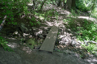
About 0.3 mile up the road is the small parking area and trailhead. A short distance after the trailhead there is a little bridge and another charming waterfall.
 |
| Bridge at beginning of trail |
 |
| Waterfall just north of the bridge |
About 0.2 mile from the trailhead there is an intersection of trails. The Rattlesnake Gulch and Birch Hollow Trails go off to the left and right here. The Grandeur Peak trail stays straight (the sign for it in the picture below is perpendicular to the other labeled trails).
 |
| Intersection of trails |
The trail continues near the stream and through a pleasant shady forest area for just under a mile up. After that, there are some sunny and shady patches, but overall the trail continues to open up more with less shade. There are occasional side paths, but the main trail is easy to see and follow.
 |
As the trail opens up, some nice views of the mountains
appear. These get better as you continue up. |
 |
| Approaching Grandeur Peak |
 |
| Penstemon growing along the trail |
 |
| Trail curving around to top right before the peak |
The views from the top are fantastic. The Salt Lake Valley stretches out below to the west while surrounding peaks jut up nearby to the south and east. Parley's canyon lies north which goes up into Dell Canyon, and up this canyon Mountain Dell and Little Dell Reservoirs appear as blue patches.
 |
| Salt Lake Valley |
 |
| Mount Olympus and part of the Salt Lake Valley |
 |
| Mountains looking East |
 |
| Mountains looking South |
 |
| Mountain Dell and Little Dell Reservoirs |
After soaking in the view, hikers can return the way they came.
This trail is located up Mill Creek Canyon, which does require a $5 fee upon leaving the canyon to access it. Dogs are permitted off leash on odd days, but must be leashed on even days. There are vault toilets along the road in the picnic area at near the trailhead as previously explained.
Directions
This trail is located up Mill Creek Canyon near Salt Lake City, Utah. To get there from the north, take 1-15 to Exit 304 and head east toward Cheyenne on I-80. Take Exit 128 for the Belt Route/I-215 and head south. Next, take Exit 4 and turn left on 3900 South, then turn left onto Wasatch Blvd. Take the first right onto 3800 South/Mill Creek Canyon Rd. Head up this way for about 3 miles to get to Church Fork Picnic Area. You can try to drive up this road to the end where the trail starts, but there is very limited parking up this way for hikers, and it nearly always full. Most likely you will have to park along the road near the turn-off and walk up to the trailhead.
To get there from the south, take 1-15 to Exit 298 for the Belt Route/I-215 and head east.
Next, take Exit 4 toward 3900 South, then turn left onto
Wasatch Blvd. Turn right onto 3800 South/Mill Creek Canyon Rd. and continue up the canyon as explained above.
GPS Coordinates for the trailhead: N40° 42.041' W111° 44.545'
GPS Coordinates for the turn off to Church Fork Picnic Area: N40° 41.858' W111° 44.548'


