Showing posts with label Weber County. Show all posts

May 25, 2026

Skull Crack Trail

The Trail

This moderate trail is 2.4 miles long (one-way) with a 350 ft elevation change. The trail starts at the southwest corner of the Causey Reservoir, heads up on the southern hillside, and ends at the southeast corner of the reservoir.

Topographical Map


Graph of Elevation


Trail in Google Earth

The trail starts heading gradually uphill from the trailhead as it ascends the hill by the reservoir. It is easy to follow with patches of shade along the way.

Trailhead
 
Parking wraps around the road way up from
the trailhead on a busy day

There are some nice views of the surrounding cliffs and inlets of the reservoir along the way.


The trail ends as the reservoir narrows into the mouth of the Right Fork South Fork Ogden River. The trail that continues from here becomes the Lake Ridge Trail. This is a pleasant shady spot to take a break if desired before heading on or turning back to the trailhead.


Directions

This trail is located on the east side of Weber County, Utah. From I-15, take Exit 344 for 12th Street in Ogden. Continue straight along this road and up through the canyon. The road continues past Pine View Reservoir, curving around northward after the reservoir. Continue along UT-39 by turning right/east at the major junction. There are signs also indicating the way toward Causey Reservoir here. Continue about 8.3 miles to Causey Reservoir Rd, and turn right here. Next take a right at Forest Road 20016 to head across that dam. Continue down and around the tip of this southwest arm of the dam to the parking area at the trailhead. Be aware that this reservoir can become very congested during weekends and holidays, so you may have to park a good way up the road and walk down to this location if you come during a popular time. GPS Coordinates: N41° 17.389' W111° 34.976'

May 26, 2025

Jump Off Canyon

The Trail

This moderate loop trail is 3.1 miles round trip with about a 1000 ft elevation change.

Topographical Map (blue = Jump Off Canyon; red = Canal)

Graph of Elevation

Trail in Google Earth

The trail starts just off Harrison Blvd. heading east toward the mountains. Hikers will quickly come to a stump that has been made into a funny figure with arms and a face. The trail soon reaches a split at which you can go around the loop in either direction. We turned right at this point, so that is reflected in the descriptions here. 

Trailhead sign

Stump Figure


After hiking about a half mile from the trailhead, there is a small turn off immediately before the cement wall holding the canal water. Take this path to head up the hill further. The wider straight path following the cement here is the canal trail, marked in red on the maps above.

Canal Trail

Turn-off right before the canal to continue up the mountain

Continue up the trail until coming to another split. At this point, one trail continues straight along the side of the mountain while the other heads up into the canyon. Take this later trail to head toward the back of the canyon.

Trail split; head right toward canyon

Trail heading toward canyon

From here, the trail becomes more rocky and starts to climb more steeply. There is a trail to the side of the riverbed, but sometimes it is easy to end up along the riverbed instead. Continue to climb to the back of the canyon, where you will reach a rock wall. At times, water does come down here creating a waterfall, but most of the year it remains dry. 
 
Approaching cliff walls at back of canyon
  
Drop off where waterfall runs at times

Looking up at cliffs at back of canyon

View looking out from back of canyon

After enjoying the jagged cliffs at this point, return the way you came until reaching the split. To complete the full loop, turn right and continue back down along this side of the loop, making sure to turn off the Bonneville Shoreline Trail and back toward the trailhead when you reach the trail descending. There are a number of signs clearly marking turn-offs and labeling trails that help with this.


Dogs are permitted on this trail, and there are even a couple water bowl stations that can be filled with your water to allow your pup to drink. There are no restrooms at the trailhead.
 
Directions

This trail is located in Ogden, Utah. To get there from I-15, take Exit 344 for 12th Street in Ogden and continue east to Monroe Blvd. Turn left here, then turn right onto 700 S. Continue to Harrison Blvd. and turn left. Continue north for just over a mile until you reach the trailhead on your right. 

If you are coming from an area north of the trailhead, it may be faster/easier to take US-89 to this point, following it until North St., heading south on Collin's Blvd./1000 E, and then onto Harrison Blvd.

GPS Coordinates: N41° 16.004' W111° 56.841'
 

July 15, 2024

Sardine Peak Loop

The Trail

This moderate trail is about 8.4 miles long round trip when done as a loop, with about a 1,312 ft. elevation change. However, keep in mind that there is some up and down for this trail, and the last tiny stretch to the peak is difficult with a steep slick short climb.

Topographical Map

Graph of Elevation

Trail in Google Earth

This trail starts from a metal gate in front of a dirt road in the Snowbasin area. It starts with a downward slope and heads past a pond and a stream that has cut its way into the road. This is the road that lead to the Maples Campground area, which is not actively in use any more and has no amenities.


Head down this dirt road

Another sign at the trailhead, but don't follow the trails
next to this sign

Shortly before reaching the campground and about a half mile from the trailhead, you will come to a labeled turn-off. Heading right here will take you around the loop the opposite way that we went, and is a longer way to reach the peak. For the shorter route up, keep following the road to the campground.

The campground has a road that loop around it in a circle. The left fork is shorter, but either way should take you to the opposite side of the area. At the far north side of the campground is a picnic table and the original trailhead, marked by the trailhead sign on the topographical map above. Find this trail and head up.

Maples Campground

Trailhead

In another 1.4 miles up this trail, there is another marked split. Heading left will take you to the Ogden Overlook, which is 0.6 mile off the loop trail. Heading straight will continue your hike toward Sardine Peak.

Looking up the path at Sardine Peak at the split

View at Split

Instead of taking a more gradual path up the more gradually sloped side of the mountain ridge to the peak, the trail skirts the ridge, then suddenly switchbacks across it to the west side of the peak, heads north a short ways, and climbs abruptly to the top up a slick steep ascent that we at first questioned the validity of as a trail. This trail is out of character with the rest of the trail. It does not seem to be an official trail at all, but it is the way up to the top.

The trail also continues on the east side of the peak. This is the main route widely used by mountain bikers making the loop, and it is marked by blue in the topographical map above. The turn-off for the peak can be easy to miss, but it comes right after passing a rocky ridge. It is a more narrow trail off to the left, and when we went, it was marked by a colored ribbon tied to a bush.

The turn off for Sardine Peak is easy to miss, but comes as you
round this bend on the other side of this rock.

It is tempting to use the pine trees for balance to ascend the final steep stretch to the top as it turns up, but it is far better to avoid contact with their sticky bark dripping with sap. It is wise in fact to watch for sticky spots in general around them, as the sap drips liberally into puddles on the ground in places.

Trail to the top

Trail to the top

Tree trunk dripping with sticky sap

Though steep, the way is short from here to the top, being just a bit over a hundred yards more.

View of Mount Ogden from Sardine Peak

Pineview Reservoir from the Peak

Avoiding the trees again, make your way back down. If you want to continue along the loop, turn right at the bottom to continue along the trail on the west side of the peak. This trail will circle back around to the north side of the peak and join up with the main trail again. Otherwise you can turn back and go down the way you came.

Trail along west side of the peak

Point where trail around the west side of the peak meets
back up with main trail

Taking the loop trail back down is longer with a lot of very long gradual switchbacks. There is a fair amount of shade along it much like the trail up after the road.


At the end of the switchbacks, the trees open up more and there is a bridge. Soon after the bridge, the trail splits again. Head right to continue back to the Maples Campground road the hike started on. Heading left will take you over another small bridge and toward the Wheeler Creek Loop, Icebox Canyon, and Art Nord Trailhead.

Bridge on Trail

Trail split: Go right here

About 0.6 miles after this split, the trail meets up with the road again and you can hike back out the way you came.

There are no restrooms at the trailhead. This trail is opened to leashed dogs and bicyclists. Parts of it are opened to horses.

Directions

This trail is located in Weber County, Utah in the Snowbasin area. The shortest fastest way to get there will vary some depending on the direction you are coming from. If you are coming from the south, it works best to take Hwy 89 until it comes up and connects with Hwy 84. However, if you are coming from directly west of Hwy 84 or from north of it, you can just start on Hwy 84 or exit onto it from I-15. Take Hwy 84 up the canyon to Exit 92. Turn left to get to UT-167/Old Highway Rd., and then turn right and continue along UT-167, turning left at the Sinclair Gas station to stay on the right road. Turn left at UT-226/Snowbasin Rd. Continue up the road before turning left again toward the Snowbasin Lodge/Maples Campground Access Rd. Continue along this road without taking any other left turns and you will arrive at the trailhead gate. There is parking along the street here with other parking available in the adjacent lots. GPS Coordinates: N41° 13.112' W111° 51.783'

July 01, 2024

Malan's Peak and Malan's Basin

The Trail

This difficult trail is 2.4 miles long (one way) with a 2100 foot elevation change to reach the peak. The basin is actually at lower elevation, so if those wishing to continue that far will hike down an extra 0.8 mile after reaching the peak. The trail starts at the end of 27th Street in Ogden. Head up the trails eastward toward the canyon. Although there are multiple trails in this area breaking off in different directions, they seem to connect and lead to the canyon.

Topographical Map

Graph of Elevation

Trail in Google Earth

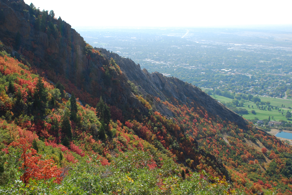
Looking up at the fall colors near the mouth of the canyon

For the first part of this trail, just follow the signs that direct you to the Taylor Canyon Trail. 

This one both says Taylor, but the smaller print
makes it clear to head along the north trail
toward Malan's Basin

Continue up the Taylor Canyon Trail about 0.9 miles from the trail head. At that point, there is a well marked turn off for Malan's Peak to the right heading over a bridge and up the slope. After taking this turn off, the trail will go up a few long switchbacks until you reach the peak.

The trail gradually gets slightly steeper as you go up, but overall the climb is pretty steady. This trail is also pretty well shaded most of the way. Just over one mile up, hikers will hit a nice view point overlooking the valley at the end of the first switchback up the slope. This also makes a nice stopping point for anyone looking for a shorter trail.


The slopes and valley from the view point just over 1 mile up the trail.

There are too many trees along most of the switchback to get many good views of the surrounding peaks, but things do open up a bit here and there.


The view from the peak is fantastic. Whether looking toward the valley:

Or looking toward the peaks and slopes:

Looking up toward Mount Ogden


Looking southward from Malan's Peak

Malan's Peak isn't really a true peak, but it's a great point to hike to in a relatively short distance. If you want to go even further, you can continue to Malan's Basin as shown in the maps above. The trail drops down and continues roughly 0.8 miles to this point, where a plaque marks the site of the Malan Heights Resort. This area is a popular place for camping by backpackers as well.

Hikers who continue past the plaque and turn right may find the overgrown trail that took us to the old hotel broiler. This hotel was burned down in a forest fire started by hunters in 1910, and the broiler is all that is left of it.


Those up for an even longer hike could continue up to the top of Ogden Peak from here, but it is a very difficult trail with lots of bushwhacking.

This trail is opened to leashed dogs. There are no bathrooms at the trailhead.

Directions

This trail is located in Weber County. To get there, from I-15 take Exit 341 for 31st Street in Ogden. Head east on 31st Street until you reach Washington Blvd. Turn left on Washington, and then take the next right onto 30th Street. Continue to Harrison Blvd. and turn left. Then continue to 27th Street and turn right. Continue until the street dead-ends. This is where the trail starts. There is no parking lot, so you will have to park along the street. Please be respectful to the residents and their properties near the trail head.