May 10, 2012

Point Lookout Trail

The Trail

This moderate trail is about 1.15 miles long (one way) with and elevation change of 500 feet. The first part of the trail is made up of a series of switchbacks through pinyon-juniper forest that climb to the top of the narrow mesa before the trail flattens out. Pets are not allowed on this trail.

Topographical Map

Graph of Elevation

Trail in Google Earth

From the top of the mesa, hikers are rewarded with fantastic views of the surroundingMontezuma and Mancos Valleys as well as the north rim of Mesa Verde. You can also see the park entrance and watch cards winding their way up the road into the park.


View of Ute Sleeping Mountain
Trail heading up switchbacks


Directions

This trail is located in Colorado in Mesa Verde National Park. The park is located along US-160. After paying required fees and entering the park, continue to the Morefield Campground. Turn right onto campground road and continue along this road to the parking lot for the amphitheater at the end. The trail starts at the north end of this parking lot.

Knife Edge Trail

The Trail

This easy trail is only 1 mile long (one way) with just a 78 foot elevation change. This trail follows part of what once was the narrow Knife Edge Road, which was built in 1914 as the main access to the park. When the Morefield-Prater Tunnel was built in 1957, this section of the road was no longer used. The trail overlooks the Montezuma Valley, and is said to be a great place to watch the sunset. Pets are not permitted on this trail.

Topographical Map

Graph of Elevation

Trail in Google Earth

View of Mountains and Valley

Looking up at Point Lookout


Looking out from point at end of the trail

Directions

This trail is located in Colorado in Mesa Verde National Park. The park is located along US-160. After paying required fees and entering the park, continue to the Morefield Campground. Turn right onto campground road and continue along this road until reaching the trail head on the left.

May 09, 2012

Petroglyph Point Trail

The Trail

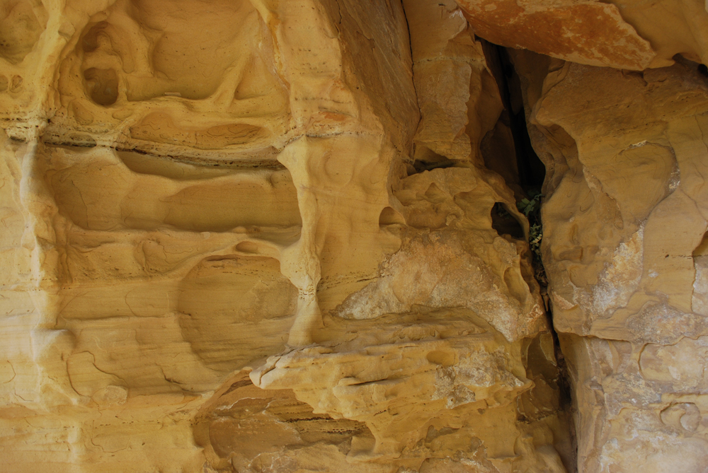
This moderate trail is an approximately 2.8 mile long loop with a 187 foot elevation change (however, keep in mind that this trail does go up and down a fair amount). The trail weaves through rock crevices, up and down narrow stairways, and under sandstone overhangs. Hikers pass a number of interesting rock formations, some cliff house ruins, and other objects of interest before reaching the petroglyphs themselves. It is definitely a beautiful and interesting trail that is well worth the hiking effort!

Topographical Map

Graph of Elevation

Trail in Google Earth

The trail starts from nearby the Chapin Mesa Museum. Walk along the asphalt path following the signs toward the Spruce Tree House (which is also worth looking at). The the Petroglyph Point and Spruce Canyon Trails start near the Spruce Tree House exit sign. These two trails soon separate; follow the signs to stay left on the Petroglyph Point trail. If you want, you can buy a trail guide, which gives additional information about plants, the ruins, the petroglyphs, and other things of interest along the trail.

Before you hike this trail, you need to sign in either at the box on the trail or at the museum. Note that this area and trail have opening and closing times. From April to October the hours should be from 8:00 a.m. to 6:30 p.m. However, hours change depending on the season. Contact the park for current hours. Pets are not permitted on this trail.


You will find the petroglyphs at the far end of the trail at marker 24.

Petroglyphs


After the petroglyphs, the trail makes an abrupt climb to the top of the mesa before turning back towards the museum. The second half of the trail runs through the pinyon-juniper forest and is much faster to hike than the first part of the trail. At the end of the hike, the trail crosses a dam and offers a nice view of the Spruce Tree House ruins.

Spruce Tree House

Directions

This trail is located in Colorado in Mesa Verde National Park. The park is located along US-160. After paying required fees and entering the park, continue to the Chapin Mesa. At the four way stop, turn right to enter the museum and Spruce Tree House parking area. The trail starts next to the museum.

Soda Canyon Overlook Trail

The Trail

This easy short hike is only 1.2 miles long round trip with a 68 foot elevation change. It leads to three lookout points that overlook the canyon. These points also offer a nice view of Balcony House, especially if you have binoculars. One of the points offers a telescope allowing you to more closely view the Balcony House ruins. Pets are not permitted on this trail.

Topographical Map

Graph of Elevation (does not include way back)

Trail in Google Earth

View of Balcony House
View of Canyon


Directions

This trail is located in Colorado in Mesa Verde National Park. The park is located along US-160. After paying required fees and entering the park, continue to the Chapin Mesa. Keep right at intersections to reach the Cliff Palace Loop. This trail is found at the last turn out located along this loop.

November 29, 2011

Ensign Peak Trail

The Trail

This moderate trail with a 415 foot elevation change that is only a half a mile long (one way). The trail starts at a well maintained area with stairs leading up to a spot with informative plaques. From here, the trail begins a steady climb to the peak. The very first part of the trail is paved, but this quickly gives way to dirt. The path is easy to follow, and there are a number of available resting places on the way up marked by cement blocks that can be used as seats.

The trail itself is not particularly scenic at this time of year. However, the view of the valley from the top is fabulous. This is also a spot of historical importance. Only a couple days after Mormon pioneers arrived in the Salt Lake Valley, Brigham Young and several others hiked to the top of Ensign Peak to get a better look at the valley. At the top they engaged in pray and counseled together about plans for the new city.

Topographical Map


Graph of Elevation

Trail in Google Earth

View of Downtown Salt Lake City from Ensign Peak

18 ft. High Monument at the Peak


Directions

This trail is found at the north end of Salt Lake County. To get there from the south, from I-15 take exit 309 for 600 North in Salt Lake City. Continue straight to Wall Street and turn right. From there, take the second left onto Zane Street, and then take a right on Columbus Street. Almost immediately, turn left onto 5th North. At the end of this street, turn left onto Capitol Blvd. Continue up the hill and turn left on Edgecomb Dr. As you continue straight, the road will change into Ensign Vista Dr. The trail head will be on the left across from the church.

If you are coming from the north, take exit 312 for Beck Street. Turn left onto Victory Road. Continue on Victory Road to 5th North, and turn left. Continue as explained above.

November 01, 2011

Curly Springs Trail

The Trail

This moderate trail has a 1479 foot elevation change and is about 5.3 miles long (round trip). The Curly Springs Trail is actually just the trail that crosses in front of Big Baldy. To get to this trail, you must first travel up Battle Creek Canyon or Dry Canyon. When doing this hike, we started up the Dry Canyon Trail and then went down Battle Creek, so the elevation graph and descriptions below reflects that route.

Line of trees on ridge near turnoff for the viewpoint
The trail up Dry Canyon starts with a good climb up some large dirt steps. The climb continues at about the same rate until the trail splits at around .7 miles up. Dry Canyon Trail continues up until it connects with the Timpanogos Perimeter Trail, and from there hikers can continue to the top of Big Baldy if desired. However, for the Curly Springs Trail, turn off at this split onto trail 051, which is the Curly Springs Trail. There are signs marking the trails clearly, so finding the turn off spot is not difficult. There are a number of turn offs leading to lower trails along the way, but if you stay on the main trail and follow the 051 markers you will stay on track.

You will find Curly Springs itself a little while after turning onto the trail (as marked by the blue flag on the map below). This is a good place to let your animals get a drink.

Topographical Map

Graph of Elevation

Trail in Google Maps

Right before the Curly Springs Trail turns and starts its descent into Battle Creek Canyon, there is a split in the trail. If you go off the main trail here you will head up to the top of the ridge where there are some great views of Rock Canyon, Mount Mahogany, Mount Timpanogos, Big Baldy, and Utah Valley. Going to this view point and back adds .5 miles to the trail. This slight detour is definitely worth the effort though, and the distance and elevation are included in the overall information for this trail.

Battle Creek near where trails connect -
this intersection used to be poorly marked

Most of the trail up to this point is open, but as descent starts into Battle Creek Canyon, the trail dips into a cooler wooded area. The trail then crosses Battle Creek itself and connects with the trail named after it. If you are completing this trail in the opposite direction, coming up Battle Creek and down Dry Canyon, the intersection used to be very difficult to find. However, it has since been improved with clear trail signs and markers.

Trail sign marking Battle Creek
intersection

Looking at Curly Springs Trail turn-off from
Battle Creek Trail

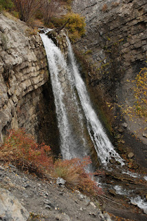
The Battle Creek Trail follows the creek down to the the mouth of the canyon. (If you were to head up it, this trail would also connect with the Timpanogos Perimeter Trail and the trail to the top of Big Baldy.) Be prepared to cross the creek several times on the way down. Some spots have bridges or other implements to help hikers cross, but other spots don't have much along those lines. This presents more difficulty in the spring during high run off than in the fall though.  About .8 miles down the trail you will find the 50 foot tall Battle Creek Waterfall (marked by a blue flag on the topographical map). From here is is about .6 more miles to the Battle Creek trail head.

This last portion of the trail makes a nice short hike in and of itself that is suitable for families. It is especially nice in the summer to take that little trek up to the waterfall and play in the water below.

These trails are open to animals. There are also some campsites available for backpackers along the way. Restrooms are available at the trail heads.

Heading up Dry Canyon

Looking up Dry Canyon Trail toward Timpanogos at the trail split

View of Timpanogos and Big Baldy from the view point

Battle Creek Fall


Directions

This trail is found in Utah County. If you are starting from Dry Canyon (as we did), from I-15, take Exit 273 for Lindon/1600 N Orem. Head east on 1600 North until you reach 400 West. Turn left on 400 West, then turn right on 2000 North/200 South. Continue up the hill to the to the top of 2000 North, then turn left onto Dry Canyon Dr. Follow the road up to the parking lot where you will find the trail head. GPS Coordinates: N40° 20.498' W111° 40.601'

If you are trying to reach the Battle Creek Canyon trail head, from I-15, take Exit 275 for Pleasant Grove/Lindon. Head roughly east on Pleasant Grove Blvd. to State Street and turn right. From State Street, turn left onto 200 S/Battle Creek Dr. Continue straight up this road until you reach the park at the end. The trail starts from the park. GPS Coordinates: N40° 21.786' W111° 42.046'