This 1.3 mile long trail (one-way) is mostly easy with only a 166 foot elevation change. The trail is fairly flat until the very end when it reaches the "lair," at which point there is a short steep climb up to an opening and then some rock scrambling to get down into the chamber.
 |
| Topographical Map |
 |
| Graph of Elevation |
 |
| Trail in Google Earth |
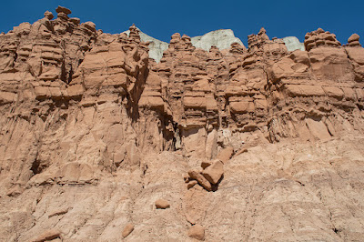
The trail starts just north of the first Valley of Goblins. It circles around to the back/east side of the mountains and other rock formations that create a backdrop to Goblin Valley.
At the very end of the trail, the path curves back into the mountains. To reach the chamber, hikers must climb up a steep rock-strewn path.
 |
| Path into Goblin's Lair |
Once at the top of this path, one may peer down into the chamber below, and scramble down the rocks here at the entrance to get inside.
 |
| At entrance of chamber from the top of trail |
 |
| Cave Opening |
 |
| Popcorn on the walls |
 |
| From the back of the chamber looking toward the rocky entrance |
Be aware that this trail has little shade and can be very hot, particularly during the middle of the day in the summer. There are chamber toilets available at the parking lot, but there isn't any water unless you are go to the campgrounds or the station at the park entrance.
Directions
This trail is located in Goblin Valley State Park, which is in Emery County, Utah. The closest town is Hanksville, followed by Green River. To get there from I-70, turn south onto UT-24. Next, turn west onto Temple Mt Road. Continue to Goblin Valley Rd. and turn left. You will have to pay to enter the park at the station. From there, continue along Goblin Valley Rd. to the parking lot. The trail starts at the north side of this parking area.


No comments:
Post a Comment