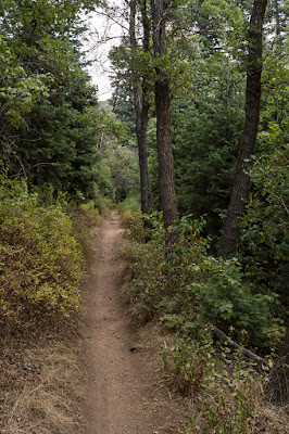
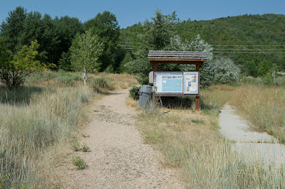
There are multiple options for hiking to Rudy's Flat. If you start at Mueller Park and end at Canyon Creek Dr. as shown in the information below, this moderate hike will be about 10.5 miles with a 1840 foot elevation change (including a very short trip at Elephant Rock). The distance from the Mueller Park Trailhead to Rudy's Flat is about 6.6 miles, and the distance from Canyon Creek Dr. to Rudy's Flat is about 3.8 miles (including the 1.2 mile long rough dirt road). We started at Mueller Park, so the information below reflects that route.
 |
| Topographical Map |
 |
| Graph of Elevation |
 |
| Trail in Google Earth |
This trail has lots of shady areas along the way, as well as some open areas with nice views. About 3.4 miles up the trail there is a split in the trail. The more well used path goes to Elephant Rock, which is just off from this point. There is a bench there, and if desired you can walk down the slick trail and climb up onto this rock.
 |
| A Mountain Ash along the trail |
 |
| Elephant Rock |
The other path switches back the opposite direction and continues on to Rudy's Flat, another 3 miles up the trail.
Rudy's Flat is an open area that is commonly used for camping. This is the high point of the trail...the rest is pretty much downhill from here.
Unfortunately, the day we went was very smokey, so the views along our way were pretty obscured. However, there are normally some nice views on the way back, including a view of the LDS Bountiful Temple.
 |
| A gopher snake on the trail |
About 2.5 miles after Rudy's Flat the trail comes to a very rough dirt road. There is also a dirt parking area here, but you better have a good way to get up this far in a vehicle. At least while we were there, there was a very large pit in the middle of this road that had turned into a very small pond. Water running down from this point had created a deep gully along one side of the road for a ways after that.
 |
| Dirt parking area at end of the dirt road |
 |
| "Pond" in middle of the dirt road |
Like much of the rest of the trail, the hike along this dirt road has many patches of both sun and shade. If you try hiking up this trail toward Rudy's Flat, just be aware that there are a number of small roads that turn off from the main road. Make sure you stay on the main road, which pretty much follows the gas line up the hill.
 |
| Looking back at another dirt road splitting off from the main road on the left |
Near the end of the road, there is some private property to the south with lots of warning signs to not trespass. Not long after that, hikers will find themselves on Canyon Creek Dr.
 |
| Trailhead at the end of Canyon Creek Dr. |
This trail is open to leashed dogs and horses, and it is a very popular biking trail. Furthermore, this trail is great to hike during most of the year. It can be snowshoed when there is enough snow in the winter, and it clears of snow pretty early in the spring. There are no restroom facilities nearby unless you pay to go into the picnic area just up from the trailhead at Mueller Park.
Directions
This trail is located in Davis County in Bountiful, Utah. If you plan to start at Mueller park and if you are coming from north of Bountiful, take Exit 316 off of I-15 and head east on 500 S. Turn right onto 500 W and then take a left at 1875 S. This road will continue into 1800 S and then into Mueller Park Rd. If you continue continue past all the houses, you will come to a small parking area on your left. The trailhead is found at this parking area. However, there is not a lot of parking here, and you will likely need to park along the street further down along the residential area. If you continue past this parking area, you will reach the picnic area for which there is a fee to use.
If you are coming from south of Bountiful, take Exit 315 off of I-15, and then head east on 2600 S. This road will curve north and become Orchard Dr. From Orchard Dr., turn right onto 1800 S and continue as explained above. GPS Coordinates: N40 51.832 W111 50.207
If you are heading to the Canyon Creek Dr. Trailhead, take Exit 315 off of I-15 and head east on 2600 S. When you get to 500 W, turn right and head south until this road intersects with Orchard Dr. Turn right onto Orchard Dr, and then take the next left onto 3100 S. Continue to Indian Springs Rd. and turn right. This will run into Canyon Creek Rd. Turn right here and continue up the road to its end. GPS Coordinates: N40 50.778 W111 51.205


