The Trail
This moderate 2.8 mile (one way) trail has about a 890 ft. elevation change. The trail starts in Snowbasin and follows a dirt road for a ways before turning into a narrower hiking/bicycling trail as it continues to the overlook.
 |
| Topographical Map |
 |
| Graph of Elevation |
 |
| Trail in Google Earth |
This trail starts at a metal gate and heads north along the wide dirt road on the other side. It actually starts with a slight descent for almost a half mile before changing to and uphill incline. There are a number of smaller side trails heading off from this main dirt road, but to go the right way, stay on the wide road. There are lots of meadows and a little pond along the way.
 |
| Trailhead |


About 0.6 miles up the trail there is another clearly labeled trail off to the right. This trail is part of a loop option for Sardine Peak that is about 7.5 miles long as is popular for bicyclers, though it is more popular to come down this part of the trail than go up it.
 |
| Trail intersection for Sardine Peak Loop |
A little ways further up the trail there is a meadow area that used to be part of the Maples Campground before it was abandoned. Campers can still hike in and stay in the area away from the trail, but there are no services. Stay in a northerly direction here and you will come to a split in the road where it actually just loops around. Turning left is shorter, but either option will take you to the original trailhead at the other side of this loop.
 |
| Open meadow/former Maples Campground where the road splits for a loop |
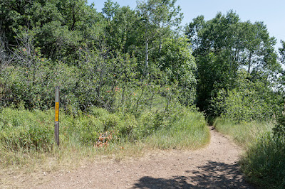
After hiking about 0.8 miles from the metal gate, you will come to this trailhead next to a picnic bench, marked by the trailhead sign on the topographical map above.
 |
| Trailhead |
 |
| Picnic Bench at Trailhead |
The trail becomes much shadier here as it makes its ways through mostly arboraceous areas.

After another 1.4 miles up, the trail splits again with a well marked option to go up toward Sardine Peak or to head out to Ogden Canyon Overlook. For the overlook, head left here.

 |
| Looking toward Sardine Peak at the trail split |
Head up a couple long gradual switchbacks before arriving at the lookout.
 |
| Switchbacks |
The outlook itself offers a nice view of Ogden Canyon and the surrounding mountains. Sardine Peak remains visible to the northeast. A handy bench offers a nice resting spot before heading down or continuing your journey.
 |
| View from the Overlook |
 |
| Sardine Peak to the Northeast |

This trail is located in Weber County, Utah in the Snowbasin area. The shortest fastest way to get there will vary some depending on the direction you are coming from. If you are coming from the south, it works best to take Hwy 89 until it comes up and connects with Hwy 84. However, if you are coming from directly west of Hwy 84 or from north of it, you can just start on Hwy 84 or exit onto it from I-15. Take Hwy 84 up the canyon to Exit 92. Turn left to get to UT-167/Old Highway Rd., and then turn right and continue along UT-167, turning left at the Sinclair Gas station to stay on the right road. Turn left at UT-226/Snowbasin Rd. Continue up the road before turning left again toward the Snowbasin Lodge/Maples Campground Access Rd. Continue along this road without taking any other left turns and you will arrive at the trailhead gate. There is parking along the street here with other parking available in the adjacent lots. GPS Coordinates: N41° 13.112' W111° 51.783'
No comments:
Post a Comment