The Trail
This moderate trail is about 0.7 miles one way with about a 300 foot elevation change. Due to multiple washes and bike tracks, the trail can be tricky to find and confusing to follow at the beginning. Many of the washes will still take you in the right direction, but it is also possible to get sidetracked out of the canyon and head more north instead of east or end up on a hillside. Studying the map and using a compass or GPS should help with this. Generally the trail stays low down in the washes until the very end.
 |
| Topographical Map |
 |
| Graph of Elevation |
 |
| Trail in Google Earth |
This trail does start out pretty wide but narrows as it goes. Stay left to start with as you go just around the first hill. The path often crosses deeper wash sections, and it is likely to be wet and muddy if there has been recent rain.
 |
| Note the bike tracks along the wide beginning of the trail |
After heading north briefly, you should turn to head more east. Don't continue north for too long or you will miss Rainbow Canyon.
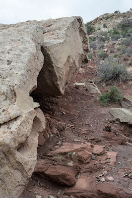
There are lots of interesting rocks along this trail that make it all the more scenic.
It is easy to miss the trail heading up to the cave if you aren't paying attention. However, it is marked with an arrow drawn out on rocks along the trail. If you miss this, you can climb up other ways, but it is far better to take the main path as it is easier and better for the area than trying to follow or make other trails up.
 |
| Arrow pointing to trail up to cave |
 |
| Trail up to cave |
This last section of trail up to the cave is easily the steepest part of the trail, but hikers are well rewarded at the top with some amazing colorful views and a rock enclosure or "cave." As you go through the cave and come out the other side, turn around to look back at it. You will find the petroglyphs on the rock just above it.
 |
| "Petroglyph Cave" |
 |
| Other side of Petroglyph Cave |
 |
| Petroglyphs |
Then continue to climb around on the rocks in the vicinity for awhile to enjoy the view! It is all the more obvious from up here where this canyon got its name.
When finished, turn around to head back the way you came.
This trail is open to pets. There are no restrooms available at the trailhead.
Directions
This trail is located in Iron County, Utah in Cedar City. To get there from I-15, take Exit 59 and head east on 200 N. Turn left at 200 E. This road changes names as it curves around, but stay on it until you reach Highland Dr., then turn left again. Turn right on the very next road, Rainbow Canyon Cir, and then continue to the dirt parking area. The trail starts by going up the wash on the left. GPS Coordinates: N37° 40.924' W113° 03.082'


No comments:
Post a Comment