The Trail
This moderate 2.4 mile trail (one way) has about a 775 ft elevation change. It boosts some nice views of the island and surrounding bays from several points along the trail.
 |
| Trail Map |
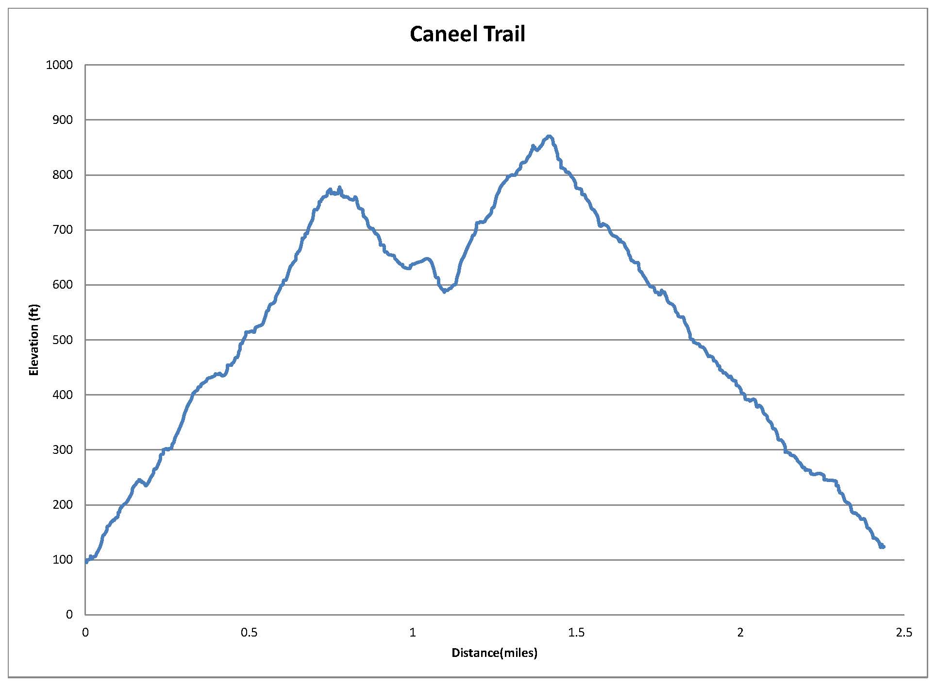 |
| Graph of Elevation |
 |
| Trail in Google Earth |
We started this trail by walking along the road to the trailhead from the visitor's center. The trail is well marked and easy to find. It climbs up the hill for about 0.7 miles to the top where a small lookout tower and bench sit. We noticed many interesting plants along the way too.


 |
| Bench at top of hill |
 |
| Lookout at top of hill |

From here, the trail continues along the ridge for about another 0.3 miles before reaching the Tamarind Trail heading down the hill to the road below. We continued along the Caneel Trail though, which eventually heads down to the road below too. It does intersect with the Water Catchment Trail, which can be followed instead for a slightly larger loop if desired. The trails are marked well with signs at the intersections. The trail ends at the road where another trailhead sign labels it here.


 |
| Trailhead at far side of Caneel Trail coming out to road |
Directions
From the dock where the ferry stops, head past the visitor's center and out to North Shore Rd. Follow this road northeast and continue through the curve northward. The trail starts at the end of this curve and is clearly marked. GPS Coordinates: N18° 20.001' W64° 47.504'
No comments:
Post a Comment