July 14, 2017

Emerald Lake Trail

The Trail
This moderate trail is 1.8 miles long (one way) with a 614 foot elevation change. Before reaching the pristine Emerald Lake, this trail passes by two other lakes: Nymph Lake (0.6 mile up the trail) and Dream Lake (1.2 miles up the trail).

Topographical Map (Blue=Emerald Lake Trail; Red=Alberta Falls Trail

Graph of Elevation

Trail in Google Earth

This is probably one of the most popular trails in Rocky Mountain National Park, so you can expect to see lots of traffic along it. The trail itself is wide and easy to follow with clearly marked signs along the way.


The first lake, Nymph Lake, has dirt banks with grasses and lilies growing in it. From the northwest side of the lake, you can catch of glimpse of Flattop Mountain peeking out from behind the hills.

Nymph Lake

Nymph Lake from northwest side

Continue up the trail past Nymph Lake and you will reach rock platform just off the trail with a nice view. From here you can look down on Nymph Lake.

View of Nymph Lake from rock


A little before you reach Dream Lake, there is a split in the trail. Keep right to continue to Dream and Emerald Lakes. Turning left will lead to Lake Haiyaha, which will be about 1.1 miles from this turn off point. At the end of June, we started encountering some spots of snow along the trail along this point as well.


Pond next to Dream Lake

Dream Lake is quite picturesque, with even better views of Flattop Mountain and Hallett Peak. It is a very long lake, and the trail continues up alongside it toward Emerald Lake. This area is also quite wet, but boardwalks keep hikers out of the swampy areas.

Dream Lake
 

After Dream Lake, the trail continues along next to the creek flowing from Emerald to Dream Lake.


Creek flowing across rocks on its way to Dream Lake

Not long after leaving Dream Lake, hikers will arrive at Emerald Lake, flanked by Flattop Mountain and Hallett Peak.

Emerald Lake with Flattop Mountain behind it

A Clark's Nutcracker at Emerald Lake

A Yellow-Bellied Marmot looking for a handout at Emerald
Lake. Please do not feed the wildlife! It is ultimately
harmful to them, and it is forbidden in the park.

Emerald Lake with Hallett Peak


Vault Toilets are available at the trailhead. Dogs are not permitted on this trail or other trails within Rocky Mountain National Park.

Directions
This trail is located in Rocky Mountain National Park, which is next to Estes Park in Larimer County, Colorado. To get there, take US-36/Moraine Ave. east from Estes Park into Rocky Mountain National Park. Note that there is a fee to enter the park. Turn left onto Bear Lake Road and continue to the parking area at the end of the road. The trail is at the far end of this parking area. Just follow the signs indicating the correct trail since there are several trails starting here at about the same spot. Note that the parking almost always fills up early in the morning, in which case you will have to park at the Park and Ride station and take a shuttle to the trailhead.


July 09, 2017

East Inlet Trail to Adams Falls

The Trail
This easy trail is only 0.3 mile long (one way) with just a 79 foot elevation change. There is also an option to do this trail as a loop, which makes it about 0.8 mile long round trip, but the maps and elevation graph here do not reflect this option.

Topographical Map

Graph of Elevation

Trail in Google Earth

Adams Falls

After you reach the falls, you can hike down lower for a better view of the lower falls too. We didn't have time for this, but we could see them from above where we were.

Looking down to lower falls from above

After reaching the falls, you can go back the way you came like we did, or you can continue the climb up a bit to the side of the falls where the trail will loop back around.


There are vault toilets available at the trailhead.

Directions
This trail is located on the west side of Rocky Mountain National Park in Larimer County, Colorado. To get there from Estes Park, take US-36/Moraine Ave. east from Estes Park into Rocky Mountain National Park. Note that there is a fee to enter the park. At the road split after entering the park, stay right heading toward Trail Ridge Rd. Stay left at Deer Ridge Junction to continue up Trail Ridge Road. Follow Trail Ridge Rd. to the west side of the park and turn left onto Portal Rd. Follow this road to the parking area on the east side of Grand Lake. The trailhead is clearly marked here.

If you are coming from west of Rocky Mountain National Park, you can get to this trail by taking CO-125 or US-40 to Granby, and then turning left onto US-34 and continuing to Portal Rd., where you will turn right and continue as explained above. If you go this route, you will not have to pay the fees to enter rocky Mountain National Park.

July 06, 2017

Alpine Ridge Trail

The Trail
This easy trail is a short 0.3 mile long (one way) but has a 224 foot elevation gain. It is also located at a very high altitude, which may make it more challenging for those not used to being at high elevations. That being said, the trail's short distance and stone stairs make it very doable for most visitors to this area. Given its fairly steep incline, it is sometimes called "Huffer's Hill."

Topographical Map

Graph of Elevation

Trail in Google Earth

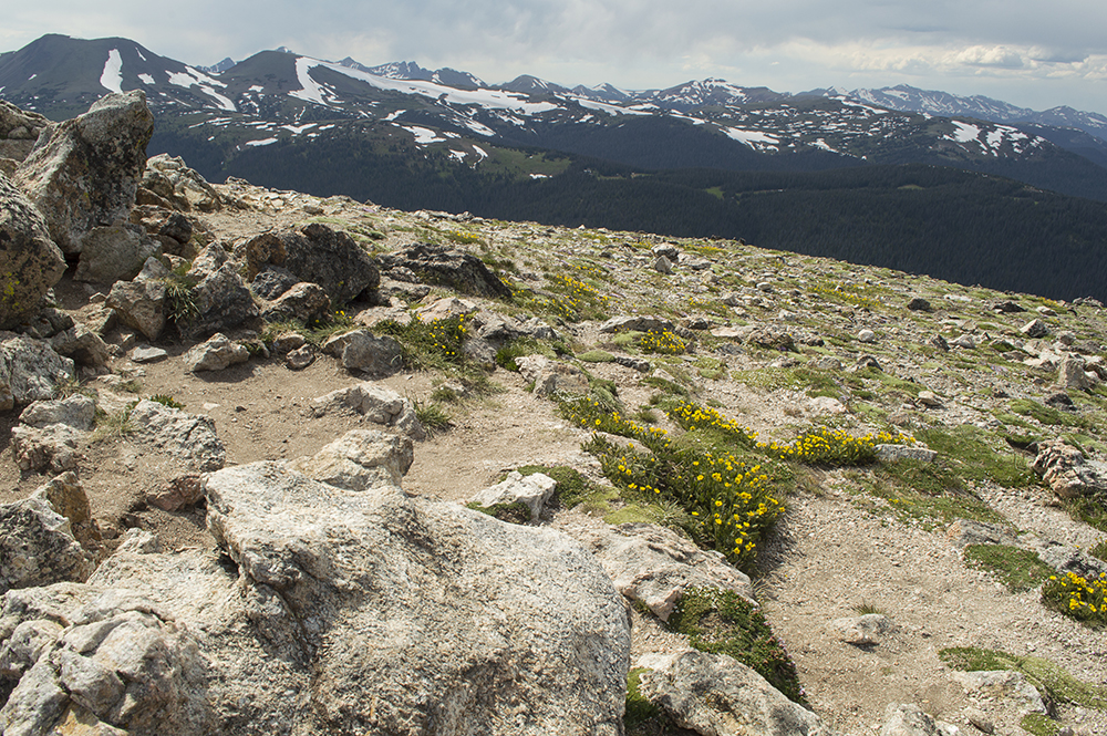
This short trail is great for viewing some of the Alpine Tundra if you don't have a lot of time or enough energy to go on one of the longer hikes in the area. There were lots of wild flowers growing along the trail while we were there, and there are scenic views of some of the surrounding mountains as well.


Alpine Avens - a favorite food for the pikas living here


It is usually very windy, and can be cold even during the summer given its high altitude.


Directions
This trail is located in Rocky Mountain National Park, which is next to Estes Park in Larimer County, Colorado. To get there, take US-36/Moraine Ave. east from Estes Park into Rocky Mountain National Park. Note that there is a fee to enter the park. At the road split after entering the park, stay right heading toward Trail Ridge Rd. Stay left at Deer Ridge Junction to continue up Trail Ridge Road. Go up this road for 17 miles to the Alpine Visitor Center parking. The trail is at the far east end of the parking area, and is easily visible from the parking lot as it heads up the slope.

July 05, 2017

Bear Lake Loop

The Trail
This very easy loop trail is only 0.7 mile long round trip with about a 30 foot elevation change. The trail circles Bear Lake offering view from the shores of all its sides.

Topographical Map

Graph of Elevation

Trail in Google Earth

There is nothing difficult about this trail, and there are lots of resting spots along the way with benches. There are nature guide brochures available at the trailhead for a fee with corresponding numbered labels along the route. The lake is picturesque with the mountains around it creating a scenic backdrop.


This trail is only for hikers. Dogs and bicycles are not permitted on the trail. There are vault toilets at the trailhead.

View of Bear Lake from atop a rock to the side of the trail

Directions
This trail is located in Rocky Mountain National Park, which is next to Estes Park in Larimer County, Colorado. To get there, take US-36/Moraine Ave. east from Estes Park into Rocky Mountain National Park. Note that there is a fee to enter the park. Turn left onto Bear Lake Road and continue to the parking area at the end of the road. The trail is at the far end of this parking area. Note that the parking almost always fills up early in the morning, in which case you will have to park at the Park and Ride station and take a shuttle to the trailhead.

June 07, 2017

Mueller Park Trail to Elephant Rock

The Trail
This moderately easy trail is about 3.7 miles one way with only about a 1000 foot elevation change. The trail is well marked and easy to follow. It is popular for mountain bikers and families alike, so you can expect it to be crowded on weekends and holidays in particular.

Topographical Map

Graph of Elevation

Trail in Google Earth

This trail climbs very gradually and pretty steadily all the way to Elephant Rock. The first half of the trail does climb a little more overall than the second half though. The trail has a good mix of shade and sun. There are patches of shade all the way up, but the first mile of the trail seems particularly shady. There are bridges and boardwalks over the streams and muddy sections of the trail.


The trail starts at a bridge just off from a parking area. It then travels up some long gently sloping switchbacks to a large rest area about 0.8 mile up the trail. There are a number of logs to rest on here and some teepee-like structures made from large branches.


About 1 mile up the trail is a view point from which Elephant Rock can be seen in the distance. It didn't stand out well in the picture below from this point, so it is circled in red.

First view of Elephant Rock (circled in red)

There are a few other points with good views of Elephant Rock as you continue hiking up the canyon.

Another view of Elephant Rock from the trail

In the spring, there are lots of bright yellow flowers along the trail, like those of various kinds of of balsamroot.

Balsamroot
The trail splits right before Elephant Rock. You can continue straight to a resting area with a couple benches that overlooks Elephant Rock, or you can turn left to continue to Rudy's Flat, which is another roughly 3 miles up from this point.

Right after the resting area is the only relatively tricky part of the trail. If you want to continue onto Elephant Rock itself, you will have to hike down a short but steep slippery slope to the rock and then climb up it.

Elephant Rock from the back. This is the side you must climb up from
the trail to get to the top.

View from the top of Elephant Rock out toward the valley

This trail is great to hike during most of the year. It can be snowshoed when there is enough snow in the winter, and it clears of snow pretty early in the spring. Leashed dogs and horses are permitted on the trail too. There are no restroom facilities nearby unless you pay to go into the picnic area just up from the trailhead.

Directions
This trail is located in Davis County in Bountiful, Utah. If you are coming from north of Bountiful, take Exit 316 off of I-15 and head east on 500 S. Turn right onto 500 W and then take a left at 1875 S. This road will continue into 1800 S and then into Mueller Park Rd. If you continue continue past all the houses, you will come to a small parking area on your left. The trailhead is found at this parking area. However, there is not a lot of parking here, and you will likely need to park along the street further down along the residential area. If you continue past this parking area, you will reach the picnic area for which there is a fee to use.

If you are coming from south of Bountiful, take Exit 315 off of I-15, and then head east on 2600 S. This road will curve north and become Orchard Dr. From Orchard Dr., turn right onto 1800 S and continue as explained above.

January 05, 2017

Timpanogos Lower Falls Trail from Aspen Grove

The Trail
This moderate trail to the waterfall is only about 1.1 miles long one way with a 596 foot elevation change. We did do this trail in the winter this time though, and the normal trail became inaccessible at the point of the black square in the topographical map below. From that point, we hiked down toward the river and then followed it up to the falls.

Topographical Map

Graph of Elevation

Trail in Google Earth
This trail starts at a gradual incline and becomes steeper as it continues up the canyon. The trail is well used and usually easy to follow even during the winter, when it is popular among hikers, snowshoers, and cross country skiers. There are a couple trails that turn off of it, such as the Lame Horse Trail, but the trails in the area are all well marked and easy to follow. Just stay on the trail that goes to the top of Mount Timpanogos.

Looking up the trail near the beginning

After reaching the point where the trail was no longer clear or easily accessible, we made our way down to the river basin. There was a lot of deep snow and ice chunks here from what appeared to be a fairly recent small avalanche that went down the waterfall, and the river was buried under it all.


We followed the hidden river up past a wavy wall of ice to where the waterfall would normally have been, but not much of it was visible. Instead, we found a little trickle of chilly water into a deep icy puddle.


Still, the view from this vantage point was impressive!


The trail normally ends up more to the side of the fall whereas our snowshoeing trip took us nearly on top of it. Here is an old picture of what it looks like during the summer:


During other times of the year when there is less snow, hikers looking for a much longer and more arduous trail can continue on if desired up to Emerald Lake and to the top of Mount Timpanogos.

2020 Update:
We did this trail at the beginning of January again this year and it looked quite different than the pictures from 2017. The trail seemed to follow the normal trail better and we ended up with a nicer view of the falls since it was not buried as before.


Restrooms are available at the trailhead, though they may not be accessible during the winter season (we didn't check). Dogs and horses are permitted on the trail. There is a fee to access the area this trail is located in.

Directions:
This trail is located in Utah County not far from Sundance. To get there, take exit 272 off of I-15 for 800 North in Orem. Head east along 800 North until the road splits. Take the left fork to head up Provo Canyon. Continue about 6.9 miles and then turn left up the Alpine Scenic Byway, heading toward Sundance and Aspen Grove. You will pass both these places before coming to a booth where you must pay to continue. Immediately to the left there is a parking area from which the trail starts. There are multiple trailheads here, so make sure you read the signs and take the one you intend to.