May 20, 2022

Big Baldy via Dry Canyon and Battle Creek Trails

The Trail

This difficult trail is about 8.7 miles one way with about a 3,500 foot elevation change. We started by hiking up the side of Dry Canyon, so the information here reflects that direction. We just went one way and had someone who could pick us up at the end, but it is also possible to make a loop by heading back along to the Dry Canyon Trailhead along the Bonneville Shoreline Trail (not shown on these maps), or even along the Curly Springs Trail (shown in red on the topographical map below).

Topographical Map (blue=Big Baldy; red=Curly Springs)


Graph of Elevation


Trail in Google Earth

The trail up Dry Canyon involves a steady ascent that only levels off a bit in a couple places. It takes hikers past some beautiful jutting rocks and along a stream bed that is nearly always dry. Since we happened to hike on a very cold wet day though, we saw water there on this occasion.

Dry Canyon Trailhead

This trail is well labeled wit signs like this informing hikers
of distances

Looking up Dry Canyon

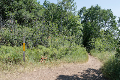
After passing the jutting rocks, a trail does head off to the left leading toward the top of the rocks, but this is not the way to go. Continue heading northeast toward the mountains. Hikers will arrive at a short flatter section of the trail with meadows. Mount Timpanogos becomes more visible as well.


Looking back down the canyon

More level section of the trail

About 0.7 miles up, the Curly Springs Trail turns off to the left. About 2.5 miles up, the Little Baldy Trail heads off to the right eventually intersecting with the Bonneville Shoreline Trail and the Provo Parkway Trail.


As hikers approach the top divide between Battle Creek and Dry Canyons, the trail levels off for a bit. Then to the left is a trail that resumes the steep ascent to the top of Big Baldy. After heading up this trail for 0.7 miles, you will be at the top to enjoy the beautiful and stunning views there.


To continue down by way of Battle Creek Canyon, after descending the path up to Big Baldy, turn left. The trail soon becomes a series of switch backs along the back side of Big Baldy. After the switchbacks, the path straightens out some and continues to an intersection 1.9 miles from the path up to Big Baldy. Continuing straight here along the Timpanogos Perimeter trail (shown in green in the maps above) would take you over to Grove Creek Canyon. To continue along the path shown in the map, turn left to continue toward Kiwanis Park. Hikers will soon come to a dirt road intersecting the trail. Just stay on the trail and continue down the canyon.


Three miles down from the trail to the top of Big Baldy, you will come to the Curly Springs Trail. This trail is much better labeled than it used to be. This trail crosses the creek and then continues up the other side.

Sign labeling Curly Springs Intersection

Looking across the creek at the
Curly Springs Trail


Roughly three fourths of the way down, hikers will come to the first real visible waterfall along thing canyon, and a short ways later come to the last and largest waterfall, both marked by blue ovals. This last waterfall is Battle Creek Fall, and is about 50 feet high. There are a couple more small falls in between.


Battle Creek Waterfall

From Battle Creek Falls to the trailhead is only 0.6 more miles. Hiking from the trailhead to this waterfall is a popular short hike that is very family friendly.

This trail is open to dogs and horses. Their are restrooms available at both trailheads.

Directions
This trail is found in Utah County. If you are starting from Dry Canyon (as we did), from I-15, take Exit 273 for Lindon/1600 N Orem. Head east on 1600 North until you reach 400 West. Turn left on 400 West, then turn right on 2000 North/200 South. Continue up the hill to the to the top of 2000 North, then turn left onto Dry Canyon Dr. Follow the road up to the parking lot where you will find the trail head. GPS Coordinates: N40° 20.498' W111° 40.601'

If you are trying to reach the Battle Creek Canyon trail head, from I-15, take Exit 275 for Pleasant Grove/Lindon. Head roughly east on Pleasant Grove Blvd. to State Street and turn right. From State Street, turn left onto 200 S/Battle Creek Dr. Continue straight up this road until you reach the park at the end. The trail starts from the park. GPS Coordinates: N40° 21.786' W111° 42.046'

August 24, 2021

Pine Hollow Peak via Pine Hollow Trailhead

 The Trail

This moderate trail is 4.5 miles long with about a 1700 foot elevation change. While there are actually multiple ways to reach Pine Hollow Peak, we started from the Pine Hollow Trailhead near Mutual Dell. You can also start from Salamander Flat, from the northern most curve in the Alpine Loop after Mutual Dell seen in the map below, or even coming from north of the peak by starting at Tibble Fork Reservoir if you are up for a very steep trail.

Topographical Map

Graph of Elevation

Trail in Google Earth

The trail starts from a large parking lot with a trail system map and vault toilet next to the start of the trail. Soon after the trail crosses the road, the trail splits with the left trail heading down and around to Mutual Dell Campground. Go right here to head up the mountainside at a gradual incline.

Trailhead

Trail heading up the mountainside

About 1.3 miles up the trail, hikers will come to a split for the Salamander Flat Campground. Stay on the Pine Hollow Trail (047) to continue up to the peak. The trail will start to open up in places and transverse through some lush meadow areas.

Salamander Flat Trail Split


The trail continues east for another 0.7 miles before intersecting with the Ridge Trail (157). Take a sharp left here to head in a more northerly direction. This is a beautiful meadow area that had an abundance of wildflowers while we were there. If you start the trail at the northern most point of the Alpine Loop after the Mutual Dell Trailhead that just shows at the bottom of the above maps, then you will be starting on the Ridge trail and come up to this intersection, making your hike much shorter.


 The trail veers west after a ways, and about 0.7 miles from the Ridge Trail intersection, the trail will start to descend for about a quarter mile before it reaches a split (marked by the green flag in the topographical map) for the Mud Trail (173). The Ridge Trail here turns off to the northeast, whereas the Mud Trail (173) will pass by Mud Spring shortly after this point. Continue left along the Mud Trail.

Mud Springs Split

Mud Spring


Another 0.7 miles up the trail from this point (3.5 miles up from the Mutual Dell Trailhead), there is one more trail split, but this one is not marked or labeled. The Mud Spring Trail continues north here and starts to descend, whereas the trail toward the peak heads west and continues to ascend the mountain. Turn left here to continue toward the peak.

Turn left here to ascend toward the peak

From here there is about one more mile until the peak. However, the best view point is not from the peak, but from a nice overlook on your way there, marked by the camera on the topographical map.

Nice view of Mount Timpanogos from viewpoint along trail

The peak itself is only an easy 0.3 miles after the viewpoint, but it is rather anticlimactic as the trees block most of the view from it. It is little more than a small pile of rocks.

Pine Hollow Peak

The trail does continue down from here quite steeply toward Tibble Fork Reservoir, shown in red on the maps above. The trail is pretty slick as well here.

We just returned the way we came up. Please note that this trail is open to bicycles, motorbikes, and horses. Even going on a day in the middle of the week, we ran into all of those, so be careful and respectful on the trail. Dogs are also permitted on this trail. There is a fee to access American Fork Canyon and the Alpine Loop.

Directions

This trail is located in Utah County along the Alpine Loop up from American Fork Canyon. To get there from south of American Fork, take I-15 to Exit 275 and turn right onto Pleasant Grove Blvd. Turn left shortly after that onto 2000 W/Country Blvd. and continue north to 11000 N. Continue up this road and into American Fork Canyon, paying the fee at the fee station. Stay right where the road splits part way up the canyon. You will continue for about 6.6 miles past the fee station before reaching the trailhead on the right.

Alternatively, if you are coming from the north, take Exit 283 for Triumph Blvd, merge onto Thanksgiving Way, and then turn left onto Triumph Blvd. Continue to UT-92, turn right onto this road, and continue east to American Fork Canyon. Pay the fee at the fee station before continuing up. Stay right where the road splits part way up the canyon. You will continue for about 6.6 miles past the fee station before reaching the trailhead on the right. GPS Coordinates: N40° 27.009' W111° 38.624'


August 03, 2021

Ogden Canyon Overlook Trail

The Trail

This moderate 2.8 mile (one way) trail has about a 890 ft. elevation change. The trail starts in Snowbasin and follows a dirt road for a ways before turning into a narrower hiking/bicycling trail as it continues to the overlook.


Topographical Map

Graph of Elevation

Trail in Google Earth

This trail starts at a metal gate and heads north along the wide dirt road on the other side. It actually starts with a slight descent for almost a half mile before changing to and uphill incline. There are a number of smaller side trails heading off from this main dirt road, but to go the right way, stay on the wide road. There are lots of meadows and a little pond along the way.

Trailhead


About 0.6 miles up the trail there is another clearly labeled trail off to the right. This trail is part of a loop option for Sardine Peak that is about 7.5 miles long as is popular for bicyclers, though it is more popular to come down this part of the trail than go up it.

Trail intersection for Sardine Peak Loop

A little ways further up the trail there is a meadow area that used to be part of the Maples Campground before it was abandoned. Campers can still hike in and stay in the area away from the trail, but there are no services. Stay in a northerly direction here and you will come to a split in the road where it actually just loops around. Turning left is shorter, but either option will take you to the original trailhead at the other side of this loop.

Open meadow/former Maples Campground where the road
splits for a loop

After hiking about 0.8 miles from the metal gate, you will come to this trailhead next to a picnic bench, marked by the trailhead sign on the topographical map above.

Trailhead

Picnic Bench at Trailhead

The trail becomes much shadier here as it makes its ways through mostly arboraceous areas.

After another 1.4 miles up, the trail splits again with a well marked option to go up toward Sardine Peak or to head out to Ogden Canyon Overlook. For the overlook, head left here.

Looking toward Sardine Peak at the trail split

Head up a couple long gradual switchbacks before arriving at the lookout.

Switchbacks

 The outlook itself offers a nice view of Ogden Canyon and the surrounding mountains. Sardine Peak remains visible to the northeast. A handy bench offers a nice resting spot before heading down or continuing your journey.

View from the Overlook

Sardine Peak to the Northeast

Directions

This trail is located in Weber County, Utah in the Snowbasin area. The shortest fastest way to get there will vary some depending on the direction you are coming from. If you are coming from the south, it works best to take Hwy 89 until it comes up and connects with Hwy 84. However, if you are coming from directly west of Hwy 84 or from north of it, you can just start on Hwy 84 or exit onto it from I-15. Take Hwy 84 up the canyon to Exit 92. Turn left to get to UT-167/Old Highway Rd., and then turn right and continue along UT-167, turning left at the Sinclair Gas station to stay on the right road. Turn left at UT-226/Snowbasin Rd. Continue up the road before turning left again toward the Snowbasin Lodge/Maples Campground Access Rd. Continue along this road without taking any other left turns and you will arrive at the trailhead gate. There is parking along the street here with other parking available in the adjacent lots. GPS Coordinates: N41° 13.112' W111° 51.783'