The Trail
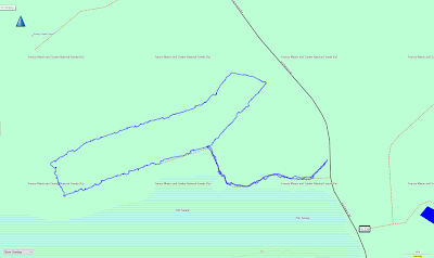
This easy trail is a flat 2.6 mile loop that only has about a 3 foot elevation change. This area was once part of a rice plantation during the 1700 and 1800s, but is now also a great place to observe wildlife living in the swamp.
 |
| Topographical Map |
 |
| Graph of Elevation |
 |
| Trail in Google Earth |
When heading up the trail and turning left to proceed around it clockwise, the first portion of the path is an interpretive trail
with informative signs. After the first mile, the signs come to an end
but the trail continues along the swampland in a rectangular loop before returning to the path back to the parking area.
 |
| Map/Trail Sign at beginning of the trail |
 |
| Informative signs like these are found intermittently along the first mile of the trail |
Near a sign warning of a "sleeping alligator zone," we spotted just such a creature laying on the trail.
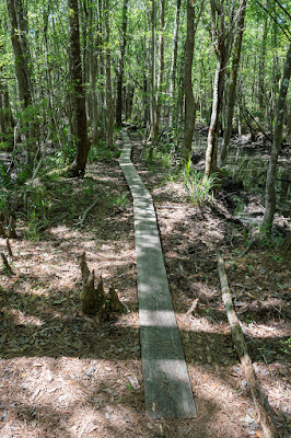
After the trail turns to head more north, the interpretive part of the trail comes to an end, but still keep an eye out for wildlife. Bridges and boardwalks allow travelers to stay out of the mud. The last section of the trail has a number of planks out to walk on.
 |
| Yellow Crowned Night Heron |
Dogs are permitted on this trail, but must be kept on a leash. This is probably a good safety tip at the very least given the presence of alligators here. A large portion of the trail is often flooded between December and March to provide habitat for birds in the area, but the rest of the year works well to hike this trail.
Directions
This trail is in the vicinity of Charleston, South Carolina, being closest to the city of Awendaw. To get there, take Hwy 17 to I'on Swamp Road. If you approach from the southwest direction, this road is a left turn little ways past a church on your left. If you are coming from the northeast, you will turn right just after the Sewee Visitor and Environmental Education Center. GPS Coordinates: N33° 00.283' W79° 40.963'


No comments:
Post a Comment