The Trail
This moderate trail is 1.3 miles long one-way to get to Long Bow arch with a 430 ft. elevation change. It involves a number of other points of interest along the way as well from dinosaur tracks to petroglyphs. This trail is shown in blue on the maps below. However, for those wishing to do the Bow and Arrow canyoneering route, a 2.5 mile loop can be made past Long Bow arch, down the rest of the canyon, and then walking back up the road to the trailhead. This technical route is shown in red in the map below and involves 4 rappels, marked by the blue flags.
| Topographical Map (Blue=Long Bow Arch Trail; Red= Bow and Arrow Route) |
 |
| Graph of Elevation (Long Bow stops at 1.3 miles in) |
 |
| Trail in Google Earth |
This trail starts at the Poison Spider Trailhead (an ATV road) at the opposite side of the parking area. It starts out with some switchbacks climbing up first to a panel of dinosaur prints and then past a few petroglyphs.
 |
| At the trailhead for Poison Spider |
 |
| Long Bow Arch Trailhead |
 |
| Dinosaur Foot Prints |
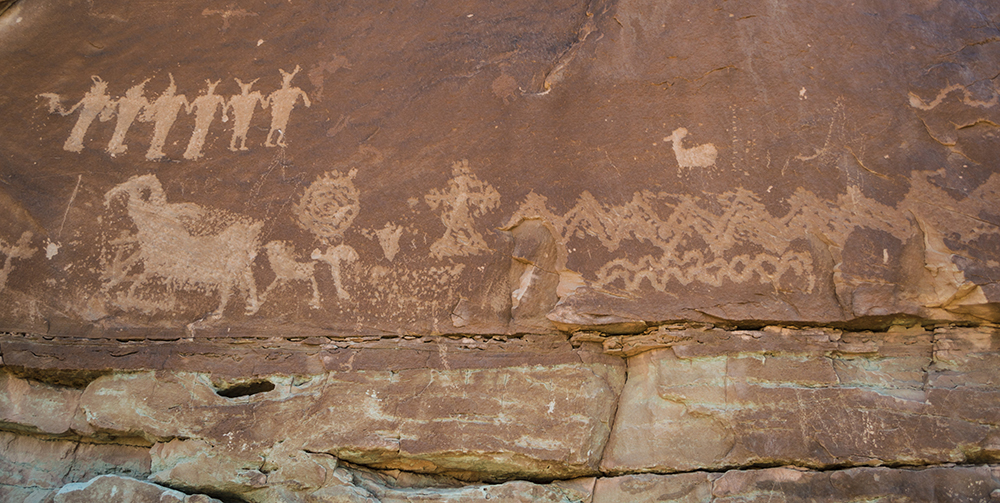 |
| Petroglyphs |
Keep your eyes out of additional petroglyphs along this trail; there are many, but I didn't take pictures of all of them. From here, continue along the side of the rock wall until you reach a small narrow arch. The trail heads right up below the arch via some metal pieces that have been bolted in the rock here to create a ladder of sorts.
 |
| Trail heading up by small arch |
 |
| Small arch from opposite side |
After heading past the arch, follow the green painted marks on stone to stay on the trail. The area opens up into a wide canyon before heading west into a narrower canyon. As the trail turns off, Long Bow Arch is visible ahead.
 |
| Trail through open canyon area |
 |
| Approaching Long Bow Arch from trail |
Long Bow Arch sits 1.3 miles from the trailhead. It pulls out gently from the rock wall behind it while boasting about 60-80 foot long span.


For those hiking the trail, simply turn and head back along the trail the way you came after enjoying the arch. Dogs are permitted on this trail, and there is a vault toilet at the trailhead.
For those wanting to engage in some canyoneering, continue up the canyon to the technical sections. Soon you will come to a high point and then start to descend. Shortly after the start of the descent, adventurers will arrive at the first short rappel point.
 |
| Looking down the canyon. Across the way are other cool places to explore like Pool Arch. Further back are the La Sal Mountains. |

 |
| Looking out at the top of the second rappel point |
 |
| Looking at the second rappel from its bottom |
Continuing down the canyon, in a additional two tenths of a mile there is a low angle 60 ft rappel. Very shortly after, you will come to the final rappel, which is roughly 75 ft.
 |
| Small pool along the route. |
 |
| Looking down the low angle rappel. Right after this one is the last rappel down to the road. |
 |
| Final Rappel |
From the bottom of the last rappel, you can make your way up the road back to the trailhead. It is roughly a half mile walk.
Directions
This
trail is located near Moab, Utah in Grand County. To get there from
Moab, head north on US-191 and turn southwest onto UT-279. Continue for 5.9 miles on this road until you come
to the trailhead on your right. The road curves around and there is a dirt parking area here. The trail starts on the far north side of the parking lot. GPS Coordinates: N38° 31.960' W109° 36.533'
No comments:
Post a Comment