July 20, 2019

Ramparts Trail

The Trail
This moderate trail is about 2 miles long (one way) with a 580 foot elevation change. However, this trail does go both uphill and downhill, so there is more climbing during the trail than just the elevation change. The trail starts with some sections of uphill climbs before reaching the high point near some water towers about a half mile up the trail. From there, the trail mostly descends to the Spectra and Ramparts Viewpoints, though there is a short climb back up to the Ramparts Viewpoint at the end.

Topographical Map

Graph of Elevation

Trail in Google Earth

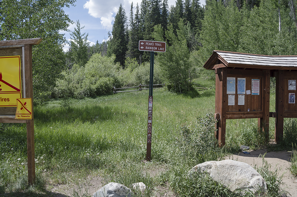
This trail starts not far from the visitor's center in Cedar Breaks. The parking lot for the trailhead is shared with the visitor's center, gift shop, and Point Supreme.


About a third of a mile up the trail there is a turn off to see a little historical cabin. This cabin is all that remains from the Cedar Breaks Lodge built in the early 1920s. The lodge was torn down in 1972, but this little cabin was forgotten and so it remains in place today. It originally housed a generator used to create electricity for the lodge, and later was used for storage.

Little Cabin

The trail past the cabin continues up to some water towers about a half mile up the trail.

 
Spectra Point is about a mile up the trail. There is a short turn-off to get to the viewpoint from the trail that continues on. The views from the point are indeed spectacular, and this is a nice turn-around point for those seeking a shorter trail.


There are also a lot of cool Bristlecone Pines all around this area and scattered about in other places on the way to the Ramparts Viewpoint.


After Spectra Point, the trail descends down some switchbacks and enters a lush forested area full of wildflowers during the summer. A pleasant stream runs through here that the trail crosses not far from the viewpoint.


Prickly Current

Columbines

Finally, the trail ends at the scenic Ramparts Viewpoint.

East View from Ramparts Viewpoint

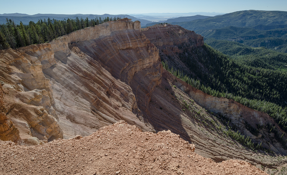
West View from Ramparts Viewpoint

Of course, there are plenty of other nice views to enjoy along the way outside of Spectra and Ramparts Viewpoints as well. Enjoy them all again on your way back to the trailhead.


Restrooms are available near this trailhead. Please note that this trail is in a national monument and there is a per person fee to access the area. This fee can be paid at the booth at the parking area.

Directions
This trail is located in Cedar Breaks National Monument, which is about 23 miles east of Cedar City, Utah. If you are coming from the south, take Exit 57 from I-15 and head east on Main St. in Cedar City. Next, turn right onto Center St./UT-14. Continue along this road for about 18 miles, and then turn left onto UT-148, following the signs for Cedar Breaks. Continue another 3.5 miles along this road until you reach the visitor's center parking area.

If you are coming from Parowan or further north, take Exit 78 off I-15 and turn left onto Main St. Continue to Center St. and turn left again, then go to Canyon Rd./UT-143 and turn right. In 16 miles, continuing straight on this road will take you onto UT-148. Go about another 4 miles to reach the visitor center parking lot for Cedar Breaks. GPS Coordinates: N37 36.717 W112 50.261

July 15, 2019

Lily Pad Lake

The Trail
This easy trail is 1.7 miles long (one way) with about a 180 foot elevation change. Just remember though, there is some up and down hill in the middle of the trail.

Topographical Map

Graph of Elevation

Trail in Google Earth

The trail starts by heading uphill at good incline, but the view from the top is worthwhile in and of itself.


The path continues through a lot of forested areas, some of which can be muddy. Luckily strategically placed stones and boardwalks help hikers keep their feet dry.


About 0.7 mile into the hike there is a glacial till, and at 1.2 miles in this trail intersects with the Salt Lick Trail.


Hikers first arrive at Lily Pad Pond, or at Lily Pad Lake #1. Whatever name you call it by, it is easy to see where it derived its name from.


Unfortunately, when we hiked this, we thought this first lake was the end. However, those who continue just slightly further - as in less than a tenth a mile - with reach a second larger lake. So, don't make the same mistake we did and miss out on another lake after coming so far!

This trail is open to dogs and horses. There are no restrooms as the trailhead.

Directions
This trail is located in Frisco, Colorado. To get there, take I-70 to Main St. in Frisco. Take exit 205 and go west on US-6. Turn left onto Wildernest Rd., which curves around and becomes Buffalo Mountain Dr. Turn left onto Buffalo Dr., then take a right on Ryan Gulch Rd. After driving another 1.9 miels, you will be at a large horseshoe type bend in the road. There is some parking on the right here along the inside of the bend. If this is full you will have to park along the residential roads and walk further up to the trailhead. GPS Coordinates: N39 37.149 W106 06.622

July 14, 2019

Rainbow Lake Trail

The Trail
This easy trail is only a mile long with a 170 foot elevation change. It is a great little excursion for even very young children with an alluring lake to explore at the end.

Topographical Map

Graph of Elevation

Trail in Google Earth

The trail starts from a dirt parking lot and is well marked with signs. The trailhead is the same as that for the Peaks Trail.


The trail crosses shallow stream areas and runs along the stream in places. There is a good amount of shade along the way too.


The lake itself has a couple easily accessible banks: one on the west side and one on the south. The trail wraps part way around the lake and continues on.


This trail allows leashed dogs.

Directions
This trail is located in Frisco, Colorado. To get there, take I-70 to Main St. in Frisco. Take exit 201 and head east on Main Street. Next turn right onto Madison Ave., then turn left onto Granite St. Take the second turn to go right on 2nd Ave. Just before the road curves around, turn right onto Cabin Green. Continue to the dirt parking lot at the end of this road, and you will find the trailhead there. GPS Coordinates: N39 34.139 W106 05.984

July 13, 2019

Quandary Peak Trail

The Trail
This difficult trail is 3.5 miles (one-way) with about a 3,375 foot elevation change. This is actually one of the more accessible 14ers to hike in Colorado, but it is still challenging, especially for those not accustomed to the elevation. The climbs are pretty steep, especially during the final accent to the top. As with other high peak hikes, plan ahead, check the weather, be prepared, and go early in the day so that you can be safely off the mountain before danger of afternoon thunderstorms. Keep in mind that half of this trail falls above the tree line.

Topographical Map

Graph of Elevation

Trail in Google Earth

There is very little parking at the trailhead, so most likely you will have to park in the overflow parking below. This does add about a third a mile to the length of the trail, and is the route shown in the information above. From this parking area, there is a trail up to the road above. Walk along this road until you reach the well marked signs indicating Quandary Peak Trail.

Large sign marking the trailhead

More signs marking where the trail starts

The trail climbs up the entire distance, but it does become particularly steep for a mile about 1.5 miles into it, and it is particularly steep during the half mile or so right before the end of the trail.


This is a popular trail though and easy to follow. The rocks have been formed into steps in a number of spots. Enjoy the views of Blue Lakes Reservoir on your way up.

Blue Lakes Reservoir
 

Looking up at the final steep ascent to the peak

Even going in mid-July there was snow on the trail. Use caution when considering sliding down snowy areas...it is easy to get going to fast and get hurt. One person there near the same time as us got off track and landed roughly. These areas can also be slick, so just use some care. Through May there often is a lot of snow, and it is common for people to also hike up here and ski down.

Final leg to the top after the steep climb

The views from the top are fantastic! This year was wet and cool, leaving the valley below and the McCullough Gulch Trail below inaccessible still and covered with snow and ice. The lakes were still iced over as well.

Looking north down at the McCullough Gulch area, Upper Blue Reservoir,
and the other smaller lakes above it.

Geological Marker at the top of Quandary Peak

View looking southwest from the peak at Mt. Lincoln and Mt. Democrat

View looking southeast from the peak toward Red Peak and
Mount Silverheels

After reaching the top, taking in the views, and enjoying the feeling of accomplishment, head back down the way you came.

 
Also, be aware there are lots of mountain goats along this trail. Enjoy watching them, but keep your distance as well. Leashed dogs are permitted on this trail. Keeping your dog leashed is especially important for safety reasons due to the other wildlife on the mountain.

Directions
This trail is located in Colorado near Breckenridge. To get there from Breckenridge, take Highway 9 south to Blue Lakes Rd. and turn right. Turn into the dirt parking area labeled for Quandary Peak. If you want to try parking at the trailhead, you can drive slightly further to McCullough Gulch Rd. and turn right. Continue a short ways until you reach the sign for the trailhead. If this area is full, return to the lower lot. Do not park out along the road in front of resident's houses. GPS Coordinates for lower lot:N39 22.957 W106 03.776
GPS Coordinates for trailhead: N39 23.124 W106 03.717