November 18, 2019

Golden Wall Loop Trail

The Trail
This moderate trail is about a 5.1 mile long loop with a 730 foot elevation change. Keep in mind though that there are a lot of up and down sections within the trail, so the total climb will be greater than this.

Topographical Map

Graph of Elevation

Trail in Google Earth
We started this loop from the Visitor's Center, crossed the street, and went in a clockwise direction around the trail, so that is what is reflected in the information in this post. However, having done it this way, we think it may be easier to follow if you actually go the other direction. There is a parking area on the south side of the road just west of the Visitor's Center that is a great place to park and start from either way even though that is also not where we started.

Starting from where we did, we headed east along the bike path to the campground. The campground was closed on the day we were there, and we ended up passing it then cutting back down to it from the bike path at the far east end of the campground. Instead of doing this, you should just enter in at the campground entrance and find the trail at the west side of the most southern loop. The trailhead is found after the group area between campsites 24 and 26. The trail immediately starts climbing and ascends some switchbacks up a rather bare hill at this point.

Trailhead in campground between campsites

Switchbacks up barren hill

About 0.8 mile up from the trailhead in the campground (and 1.7 miles from the visitor's center parking where we started) there is a split. Heading west along the ridge will take hikers to up the Buckhorn Trail to a nice viewpoint. This trail is shown in red on the maps above. Just heading up to Buckhorn Point and then back to the trailhead makes for a nice shorter trail option that would only be a couple miles long round trip. For those doing the Golden Wall Trail, going this way as a side trip will add about 0.4 mile to your hike.

Buckhorn Trail

Buckhorn Point/End of Buckhorn Trail


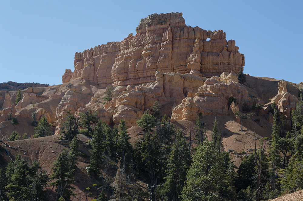
Interesting Rock Formation as seen from Buckhorn Trail

View from end of Buckhorn Trail

The views after the Buckhorn trail continue to get better along the Golden Wall Trail. There are all sorts of hoodoos right along the trail and great views of colorful sculpted rock walls.


In one spot there are some wooden "steps" hammered into a steeper section of the hillside.


Some of the hoodoos appear particularly precarious and fragile.


About 1.8 miles from the trailhead in the campground (and about 2.7 miles from where we started), the path descends into a wash, as marked by the green dot in the topographical map at the top of the post. The trail turns back out of the wash nearly immediately after that, but we missed this turn and continued up the wash for a ways before we realized we were off the main trail and found our way back up to it (our path is shown in dark green in the maps at the top of this post). The trail going the opposite direction is a bit easier to follow in this section since it is clearly labeled.

Turn back out of the wash if you go clockwise for this loop as we did

Turn out of the wash if you are headed in a counter-clockwise direction -
notice wooden sign marking the trail as it comes out of the wash


About a mile after the wash, the trail splits again at the Castle Bridge Trail. Either fork taken here will bring you back to Hwy 12, but we choose to go right/east. Both ways appear to be similar in length. After hiking another 0.6 mile, the trail will join up with the other side again and continue north back toward the road. These points where the Castle Bridge Trail loop meets are marked by blue flags on the topographical map at the top of this post. The Castle Bridge trail is also a great shorter trail option to go up from the trailhead, complete the loop, and return for about a 1.8 mile long trail.

View from Castle Bridge Trail


Directions:
This trail is located fairly close to Panguitch, Utah. It is also close to Bryce National Park and is an easy stop to make on your way there if you are approaching the park from the west side. To get there from Northern Utah, take Exit 95 and head east on UT-20. From there, turn right/south on US-89 and continue south to Panguitch. Turn left on Center Street in Panguitch to stay on US-89, and then turn left/east onto UT-12. Continue for about 3.3 miles until you reach the visitor's center on your left (where we started from) or the parking area just before the visitor's center on your right.

If you are coming from the Cedar City area, take UT-14 to US-89 and turn left/north. Continue past Hatch and then turn right onto UT-12 and continue for about 3.3 miles until you reach the visitor's center on your left or the parking area just before the visitor's center on your right. GPS Coordinates: N37° 44.748' W112° 19.155'

November 16, 2019

Arches Trail in Red Canyon

The Trail
This easy trail is a 0.7 mile loop with about a 200 foot elevation change. The trail shares a trailhead with the Loosee Canyon trail, but heads more north up out of the wash. There are some steeper areas with places where there are stairs, but the trail is not difficult.

Topographical Map (red flag = stone hut; blue flag = turn off for large arch)

Graph of Elevation

Trail in Google Earth
The trail begins in the bottom of a wash, but quickly turns out and starts climbing gradually upward. Signs indicate the right way.

Trailhead

The trail starts in a wash

A short distance up the trail there is a small hut structure made of tightly fitted rocks off to the left.


Shortly after the rock structure, the trail splits. We opted to go to the right, heading in a counter-clockwise direction around the loop. Soon after this, about 0.2 mile up the trail, there is a turn off to the left with a steeper climb up to a large arch. After this point, the trail climbs more directly up the hill where it offers some nice views.

Stairs heading up the hill


As the trail circles around, there are views of the large arch from the other side.


 Another wall of rock formations includes an interesting hourglass shaped arch.


Soon after this point we found another trail leading off to a viewpoint. Looking at maps again later and comparing it to our path, it appears that the official trail to a different viewpoint actually falls just a little ways after this, but we still enjoyed heading up to this spot.

Viewpoint Spot (unofficial)

The View


As the trail continues, there are a few more stairs.


The trail meets up at the split, and hikers can head down to the parking area the way they came.

There are restrooms at the trailhead. Just be aware that they may be close for national holidays.

Directions
This trail is located fairly close to Panguitch, Utah. It is also close to Bryce National Park and is an easy stop to make on your way there if you are approaching the park from the west side. To get there from Northern Utah, take Exit 95 and head east on UT-20. From there, turn right/south on US-89 and continue south to Panguitch. Turn left on Center Street in Panguitch to stay on US-89, and then turn left/east onto UT-12. Continue for about 2 miles to Castro Canyon Rd. and turn left. This is a dirt that is located before the Visitor's Center, so if you reach that first, you have gone too far.  Go up this road about two miles and turn into the dirt parking area on your right. This is the same trailhead as the Losee Canyon Trailhead.

If you are coming from the Cedar City area, take UT-14 to US-89 and turn left/north. Continue past Hatch and then turn right onto UT-12 and continue for about 2 miles until you reach Castro Canyon Rd. and continue as outlined above. GPS Coordinates: N37° 46.186' W112° 20.019'

November 15, 2019

Pink Ledges Trail

The Trail
This easy interpretive trail is a 0.6 mile long loop with about a 130 foot elevation change. It heads up the hill behind the visitor's center and past a number of interesting rock formations then turns and heads back to the visitor's center. Pamphlets explaining the stops along the trail can be picked up at the visitor's center.

Topographical Map

Graph of Elevation

Trail in Google Earth

The trail starts from the middle of the parking area not far from the visitor's center. Alternatively, the trail can be started from the far east end of the parking lot and it will join with the point shown above. After the first switch back, a trail heads south east that will take hikers to an old historic cabin. We didn't take the time to go here. I believe if you start the trail from the far east end of the parking area, the trail goes past the cabin.

Trailhead where we started in middle of
parking area


The trail climbs steadily and gradually past a number of interesting red rock formations before heading back down.


This trail is open to leashed dogs. There are bathrooms at the visitor's center. Just be aware that they are closed on national holidays.

Directions
This trail is located fairly close to Panguitch, Utah. It is also close to Bryce National Park and is an easy stop to make on your way there if you are approaching the park from the west side. To get there from Northern Utah, take Exit 95 and head east on UT-20. From there, turn right/south on US-89 and continue south to Panguitch. Turn left on Center Street in Panguitch to stay on US-89, and then turn left/east onto UT-12. Continue for about 3.3 miles until you reach the visitor's center on your left.

If you are coming from the Cedar City area, take UT-14 to US-89 and turn left/north. Continue past Hatch and then turn right onto UT-12 and continue for about 3.3 miles until you reach the visitor's center on your left. GPS Coordinates: N37° 44.751' W112° 19.141'