The Trail
This moderate trail is 4.5 miles long with about a 1700 foot elevation change. While there are actually multiple ways to reach Pine Hollow Peak, we started from the Pine Hollow Trailhead near Mutual Dell. You can also start from Salamander Flat, from the northern most curve in the Alpine Loop after Mutual Dell seen in the map below, or even coming from north of the peak by starting at Tibble Fork Reservoir if you are up for a very steep trail.
 |
| Topographical Map |
 |
| Graph of Elevation |
 |
| Trail in Google Earth |
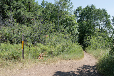
The trail starts from a large parking lot with a trail system map and vault toilet next to the start of the trail. Soon after the trail crosses the road, the trail splits with the left trail heading down and around to Mutual Dell Campground. Go right here to head up the mountainside at a gradual incline.
 |
| Trailhead |
 |
| Trail heading up the mountainside |
About 1.3 miles up the trail, hikers will come to a split for the Salamander Flat Campground. Stay on the Pine Hollow Trail (047) to continue up to the peak. The trail will start to open up in places and transverse through some lush meadow areas.
 |
| Salamander Flat Trail Split |
The trail continues east for another 0.7 miles before intersecting with the Ridge Trail (157). Take a sharp left here to head in a more northerly direction. This is a beautiful meadow area that had an abundance of wildflowers while we were there. If you start the trail at the northern most point of the Alpine Loop after the Mutual Dell Trailhead that just shows at the bottom of the above maps, then you will be starting on the Ridge trail and come up to this intersection, making your hike much shorter.
The trail veers west after a ways, and about 0.7 miles from the Ridge Trail intersection, the trail will start to descend for about a quarter mile before it reaches a split (marked by the green flag in the topographical map) for the Mud Trail (173). The Ridge Trail here turns off to the northeast, whereas the Mud Trail (173) will pass by Mud Spring shortly after this point. Continue left along the Mud Trail.
 |
| Mud Springs Split |
 |
| Mud Spring |
Another 0.7 miles up the trail from this point (3.5 miles up from the Mutual Dell Trailhead), there is one more trail split, but this one is not marked or labeled. The Mud Spring Trail continues north here and starts to descend, whereas the trail toward the peak heads west and continues to ascend the mountain. Turn left here to continue toward the peak.
 |
| Turn left here to ascend toward the peak |
From here there is about one more mile until the peak. However, the best view point is not from the peak, but from a nice overlook on your way there, marked by the camera on the topographical map.
 |
| Nice view of Mount Timpanogos from viewpoint along trail |
The peak itself is only an easy 0.3 miles after the viewpoint, but it is rather anticlimactic as the trees block most of the view from it. It is little more than a small pile of rocks.
 |
| Pine Hollow Peak |
The trail does continue down from here quite steeply toward Tibble Fork Reservoir, shown in red on the maps above. The trail is pretty slick as well here.
We just returned the way we came up. Please note that this trail is open to bicycles, motorbikes, and horses. Even going on a day in the middle of the week, we ran into all of those, so be careful and respectful on the trail. Dogs are also permitted on this trail. There is a fee to access American Fork Canyon and the Alpine Loop.
Directions
This trail is located in Utah County along the Alpine Loop up from American Fork Canyon. To get there from south of American Fork, take I-15 to Exit 275 and turn right onto Pleasant Grove Blvd. Turn left shortly after that onto 2000 W/Country Blvd. and continue north to 11000 N. Continue up this road and into American Fork Canyon, paying the fee at the fee station. Stay right where the road splits part way up the canyon. You will continue for about 6.6 miles past the fee station before reaching the trailhead on the right.
Alternatively, if you are coming from the north, take Exit 283 for Triumph Blvd, merge onto Thanksgiving Way, and then turn left onto Triumph Blvd. Continue to UT-92, turn right onto this road, and continue east to American Fork Canyon. Pay the fee at the fee station before continuing up. Stay right where the road splits part
way up the canyon. You will continue for about 6.6 miles past the fee
station before reaching the trailhead on the right. GPS Coordinates: N40° 27.009' W111° 38.624'


