To reach the far end of the lake taking the shortest route, this moderate trail is about 1.3 miles long (one way) with about a 540 foot elevation change (this route is reflected in the elevation graph below). That being said, there is a loop trail around the lake, but it goes way out around the lake, taking hikers far from the lake during most of the loop. We had some difficulty figuring out the trail since it looked different from what was shown on the trail map at the beginning of the trail, and therefore, as apparent below, we did not complete the loop around the lake. Eventually, the two trail ends connect though.
 |
| Topographical Map - blue diamond marks trail split; going right instead of left as we did here will still take you to same junction but along a different route |
 |
| Graph of Elevation |
 |
| Trail in Google Earth |
The trail starts across from a dirt parking strip on the south side of the road, and the trailhead is marked by a large stone that says "Willow Heights Conservation Area." Slightly further on there is trail sign with a map and some additional information.


The trail trail climbs at a fairly steady pace through a forested area before plateauing at the lake. It does cross water a few times.

At the top of the climb, the trail splits three ways at the end of a meadow with some nice view of the mountains. One path goes back down a different way.
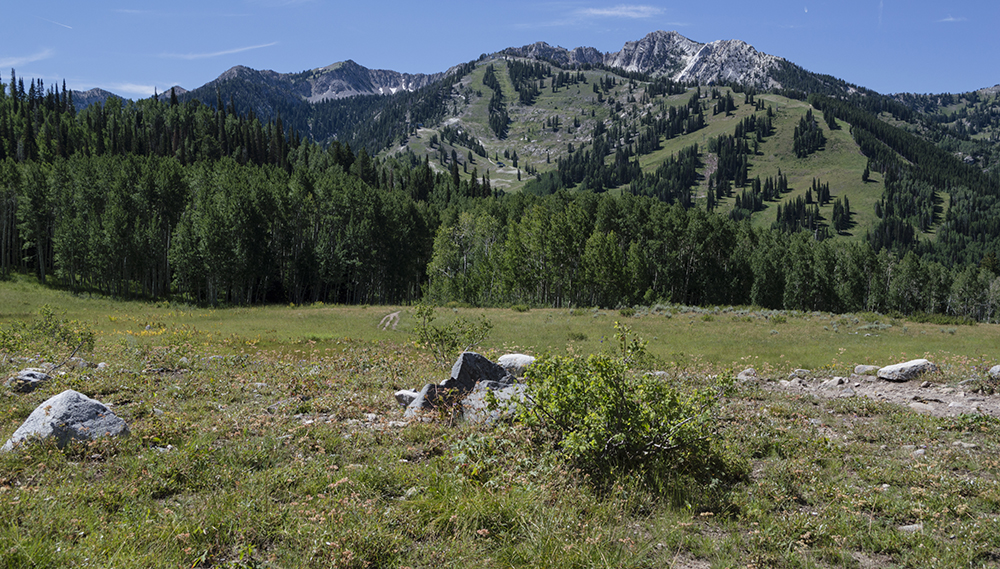
The trail to the left stretches around the east side of the lake without ever going very close to it. It heads through a beautiful aspen forest area. The trail to the right reaches the lake quickly and offers several nice places to view the lake. Ultimately, the two trails meet forming a loop.
 |
| Trail to the left heads through aspen forest east of the lake |
 |
| The trail to the right heads directly to the lake |
 |
| View from north side of the lake |

This trail is not open to dogs and there are no restrooms at the trailhead or along the trail. Swimming in the lake is also not permitted.
Directions
This trail is located near Salt Lake City, Utah and is found up Big Cottonwood Canyon. To get there from I-15, take Exit 298 to merge onto I-215 heading east. Take Exit 6 and turn right onto 6200 South. Continue on this road for about 1.7 miles, then turn left onto Big Cottonwood Canyon Rd. Head up the canyon about 1.9 miles to the trailhead. You will pass Silver Fork Lodge on the right and the Canyon Vacation Rentals on the left a little before you reach the trailhead. Park along the gravel parking strip on the south side of the road. GPS Coordinates: N40 37.820 W111 36.277