The Trail
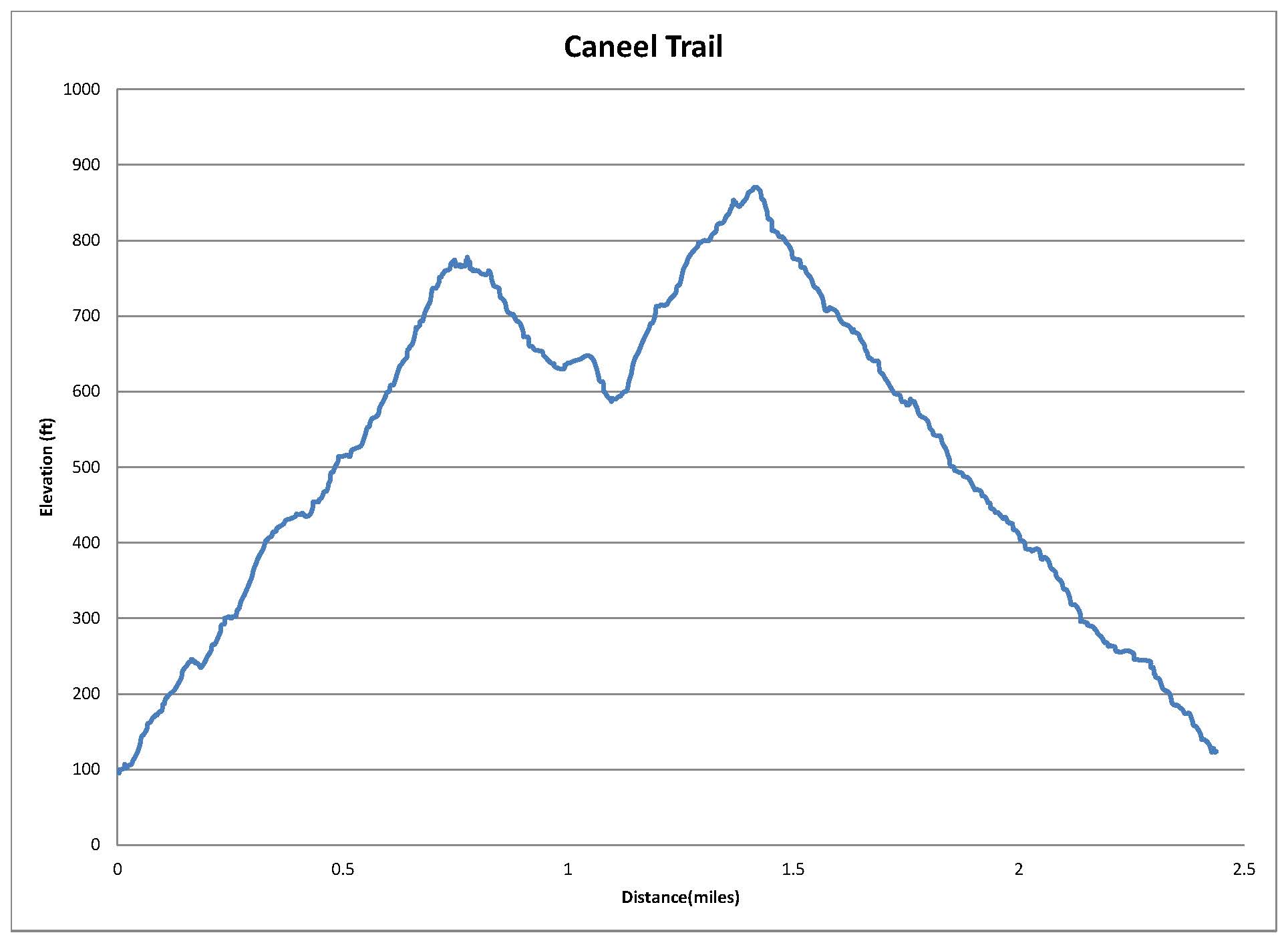
This moderate hike is only 1.2 miles long with about a 300 foot elevation change. Just remember, there is some up and down hiking as you will climb up to the fort, back down, and then up to Signal Peak. For anyone wanting a shorter trek, it's easy to just go to the fort or the peak instead of walking the whole thing.
 |
| Graph of Elevation |
 |
| Trail in Google Earth |
We started from the parking lot area and headed west toward the fort first. The trail is smooth wide, and even for most of the way to the fort.
 |
| Trail heading toward Fort Rodney |
 |
| U.S. Signal Station on way to fort |
There are ramps and steps up to the fort. There is a little lookout point along the way.
The fort is about 0.4 miles from the parking area. On top there are lovely views and the opportunity to climb down to a room below.
 |
| Looking out toward Signal Peak |
If you would like to continue to Signal Peak, go back down the fort and turn left after the signal station. It is about another 0.4 miles to Signal Peak from the fort, with a steeper climb. The trail goes past another few points of interest along the way.
 |
| Musket Redoubt |
 |
| Trail up to Signal Peak |
 |
| View from Signal Peak |
 |
| Looking at Fort Rodney from Signal Peak |
Returning to the parking area is about another 0.4 miles from the top of Signal Peak. The trail continues past other structures of interest on its way.
Directions
This trail is located on St. Lucia. To get there, take the Castries - Gros Islet Hwy to the turn off for Pigeon Island. Drive to the parking lot. GPS Coordinates: N14° 05.555' W60° 57.745'