September 14, 2019

Olomana Three Peaks Trail

The Trail
The total distance of this trail is around 5 miles round trip. However, our GPS somehow only picked up our path to the second peak, which is about 2.2 miles in to that point. This is a difficult trail that should only be attempted by climbers and experienced hikers who are not afraid of heights. This trail requires YDS class 3 and 4 climbs. There is a 1,590 foot elevation change, but there is also more climbing than this due to the up-and-down nature of this trail.

Topographical Map

Graph of Elevation

Trail in Google Earth

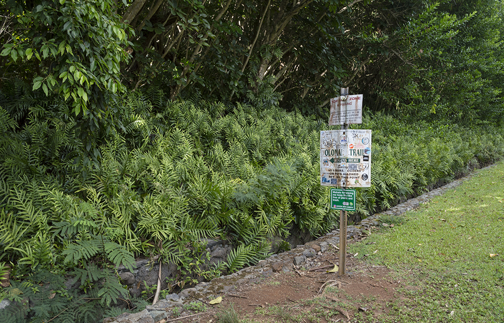
This trail starts on a private road to a golf course, and hikers should plan to park on the street before this road and walk to the trailhead. This distance is included as part of the hiking distance in the information above. As this road rounds a corner, you will pass a guard station. The guard keeps track of how many people do this trail, and he may require you to sign in. You are about half way up the road to the trailhead at the guard station. Keep going until you come to a sign on the left side marking the trailhead. (Do not go past this point unless you are a member of the golf club and thus permitted to do so). This walk to the trailhead is about 0.8 mile long. The first part of the trail involves a steady climb up through the thick foliage, but the trail is clear and easy to follow.

Guard at gold course

Sign marking trailhead

Small grove of Mexican Weeping Pines
along the trail

As you continue, the trail grows steeper, and some sections start to require some slight scrambling up rocks. There are ropes in some spots, but we found them unnecessary at this point. In general, you should always avoid relying on ropes more that you have to. These ropes are put up by other hikers, but it is impossible to know how long they have been there or how securely they will hold your weight. Always test them to make sure they will support you before trying to use them, and don't put your full weight on them while climbing unless absolutely necessary. We have seen plenty that have been well worn or half cut through at some point.


As you near the top of the first peak, you can start to get some great
views through the trees
Next you will come to a large rock that must be scaled in order to reach the first peak. If you are accustomed to climbing, it is not hard to get up, but if you haven't climbed much, you may find it a bit more challenging.


Next you come to some rocks that initially we thought we had to climb up. Then we saw there was an easier, albeit very narrow, path around just to the right.

Instead of climbing up these rocks, you can go
around them on a narrow path
Next you will arrive at the top of the first peak. The views from every side here are phenomenal and well worth the effort to get there! It is said that the views from here are the best ones out of the three peaks.


View of the next two peaks from the first

Many people stop after the first peak, which is fine. However, if you can make it up to the first peak, you shouldn't have any trouble with the second, called Paku'i, if you want to go on. It looks steep, but as long as it is dry, it is not a difficult climb.

View of next two peaks from bottom of first

Nice view of the climb to the top of Paku'i,
the second peak

Heading up Paku'i

View from the top of Paku'i

View of the third peak, Ahiki, from Paku'i

Looking back at the first peak
from the second


Things get tricky on the way down the second peak. Some describe this section as the hardest part of the trail. This path is much steeper, and there are not always great footholds along the way. Ultimately, we didn't both make it down before deciding it would be wisest to turn around. I got stuck 20 or so feet from the bottom and couldn't find a foothold. At that point, I don't know if it is possible to get down without relying on the rope. We were nervous after watching our GPS slip and go careening off the cliff and into the brush below. My husband managed to retrieve it after seeing it landed on a ledge, but only after a tricky climb off the trail to get down to it and back up. In any case, we stopped at this point and headed back. Perhaps the fall messed up our GPS track some and for that reason it seemed to not record our way down the second peak...or the GPS's plummet to the ledge just below the trail.

Path/climb down the second peak

I would have gotten more pictures of the way down Paku'i, but it was so steep that after leaving the top I didn't find any good places I felt secure enough to take out my expensive camera for a picture. That was probably wise seeing how we just about lost our GPS...We did grab a couple quick picture from a phone though.


We were sad to not make it to the third peak, but it is good to know your limits when doing this trail. It can be a dangerous one, and a number of people have died or been seriously injured trying to do it. Realize that you can stop and turn back any time, but you do have to return the way you came. Please do not attempt this trail if it is wet or if it looks like it will get wet while you are out on it. Climbing the rocks is particularly dangerous if they are wet and slippery. Wear good shoes with grip to them, bring plenty of water, and plan plenty of time.

There are no restrooms at the trailhead. Do not bring animals on this trail.

Directions
This trail is located on Oahu, Hawaii. To get there, take Pali Highway/Hwy 61 to Auloa Road. If you are coming from Honolulu, this will be after the tunnel. Turn south onto Auloa Road and find parking along this road as soon as you can. After parking, head back north on the road and take the road that turns left and runs parallel to the highway for a ways. Continue to follow this road to the guard station, around the bend, and to the trailhead. Do not go past the trailhead. GPS coordinates for the parking area: N21 22.575 W157 45.819.  GPS coordinates for the trailhead: N21 22.089 W157 45.645

August 24, 2019

Willow Lake Trail

The Trail
To reach the far end of the lake taking the shortest route, this moderate trail is about 1.3 miles long (one way) with about a 540 foot elevation change (this route is reflected in the elevation graph below). That being said, there is a loop trail around the lake, but it goes way out around the lake, taking hikers far from the lake during most of the loop. We had some difficulty figuring out the trail since it looked different from what was shown on the trail map at the beginning of the trail, and therefore, as apparent below, we did not complete the loop around the lake. Eventually, the two trail ends connect though.

Topographical Map - blue diamond marks trail split; going right
instead of left as we did here will still take you to same junction
but along a different route

Graph of Elevation

Trail in Google Earth

The trail starts across from a dirt parking strip on the south side of the road, and the trailhead is marked by a large stone that says "Willow Heights Conservation Area." Slightly further on there is trail sign with a map and some additional information.


The trail trail climbs at a fairly steady pace through a forested area before plateauing at the lake. It does cross water a few times.


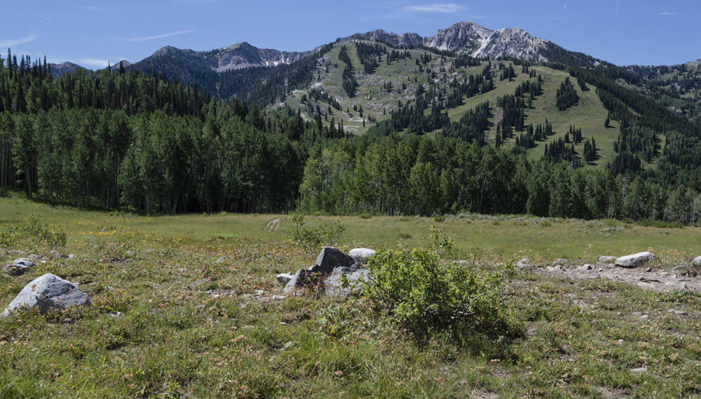
At the top of the climb, the trail splits three ways at the end of a meadow with some nice view of the mountains. One path goes back down a different way.


The trail to the left stretches around the east side of the lake without ever going very close to it. It heads through a beautiful aspen forest area. The trail to the right reaches the lake quickly and offers several nice places to view the lake. Ultimately, the two trails meet forming a loop.

Trail to the left heads through aspen
forest east of the lake

The trail to the right heads directly to the lake

View from north side of the lake
We found a lot of ducks at the lake. It was particularly fun to see a family of ducks there.


This trail is not open to dogs and there are no restrooms at the trailhead or along the trail. Swimming in the lake is also not permitted.

Directions
This trail is located near Salt Lake City, Utah and is found up Big Cottonwood Canyon. To get there from I-15, take Exit 298 to merge onto I-215 heading east. Take Exit 6 and turn right onto 6200 South. Continue on this road for about 1.7 miles, then turn left onto Big Cottonwood Canyon Rd. Head up the canyon about 1.9 miles to the trailhead. You will pass Silver Fork Lodge on the right and the Canyon Vacation Rentals on the left a little before you reach the trailhead. Park along the gravel parking strip on the south side of the road. GPS Coordinates: N40 37.820 W111 36.277

July 20, 2019

Ramparts Trail

The Trail
This moderate trail is about 2 miles long (one way) with a 580 foot elevation change. However, this trail does go both uphill and downhill, so there is more climbing during the trail than just the elevation change. The trail starts with some sections of uphill climbs before reaching the high point near some water towers about a half mile up the trail. From there, the trail mostly descends to the Spectra and Ramparts Viewpoints, though there is a short climb back up to the Ramparts Viewpoint at the end.

Topographical Map

Graph of Elevation

Trail in Google Earth

This trail starts not far from the visitor's center in Cedar Breaks. The parking lot for the trailhead is shared with the visitor's center, gift shop, and Point Supreme.


About a third of a mile up the trail there is a turn off to see a little historical cabin. This cabin is all that remains from the Cedar Breaks Lodge built in the early 1920s. The lodge was torn down in 1972, but this little cabin was forgotten and so it remains in place today. It originally housed a generator used to create electricity for the lodge, and later was used for storage.

Little Cabin

The trail past the cabin continues up to some water towers about a half mile up the trail.

 
Spectra Point is about a mile up the trail. There is a short turn-off to get to the viewpoint from the trail that continues on. The views from the point are indeed spectacular, and this is a nice turn-around point for those seeking a shorter trail.


There are also a lot of cool Bristlecone Pines all around this area and scattered about in other places on the way to the Ramparts Viewpoint.


After Spectra Point, the trail descends down some switchbacks and enters a lush forested area full of wildflowers during the summer. A pleasant stream runs through here that the trail crosses not far from the viewpoint.


Prickly Current

Columbines

Finally, the trail ends at the scenic Ramparts Viewpoint.

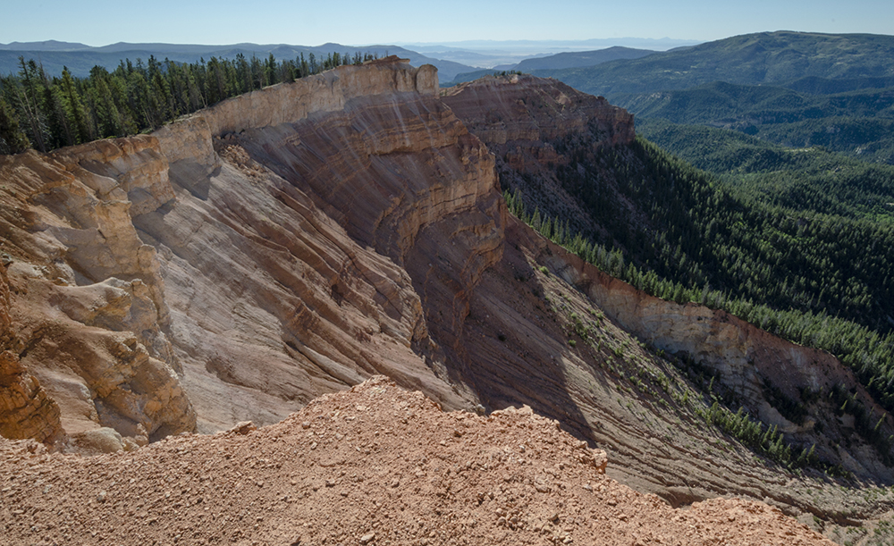
East View from Ramparts Viewpoint

West View from Ramparts Viewpoint

Of course, there are plenty of other nice views to enjoy along the way outside of Spectra and Ramparts Viewpoints as well. Enjoy them all again on your way back to the trailhead.


Restrooms are available near this trailhead. Please note that this trail is in a national monument and there is a per person fee to access the area. This fee can be paid at the booth at the parking area.

Directions
This trail is located in Cedar Breaks National Monument, which is about 23 miles east of Cedar City, Utah. If you are coming from the south, take Exit 57 from I-15 and head east on Main St. in Cedar City. Next, turn right onto Center St./UT-14. Continue along this road for about 18 miles, and then turn left onto UT-148, following the signs for Cedar Breaks. Continue another 3.5 miles along this road until you reach the visitor's center parking area.

If you are coming from Parowan or further north, take Exit 78 off I-15 and turn left onto Main St. Continue to Center St. and turn left again, then go to Canyon Rd./UT-143 and turn right. In 16 miles, continuing straight on this road will take you onto UT-148. Go about another 4 miles to reach the visitor center parking lot for Cedar Breaks. GPS Coordinates: N37 36.717 W112 50.261

July 15, 2019

Lily Pad Lake

The Trail
This easy trail is 1.7 miles long (one way) with about a 180 foot elevation change. Just remember though, there is some up and down hill in the middle of the trail.

Topographical Map

Graph of Elevation

Trail in Google Earth

The trail starts by heading uphill at good incline, but the view from the top is worthwhile in and of itself.


The path continues through a lot of forested areas, some of which can be muddy. Luckily strategically placed stones and boardwalks help hikers keep their feet dry.


About 0.7 mile into the hike there is a glacial till, and at 1.2 miles in this trail intersects with the Salt Lick Trail.


Hikers first arrive at Lily Pad Pond, or at Lily Pad Lake #1. Whatever name you call it by, it is easy to see where it derived its name from.


Unfortunately, when we hiked this, we thought this first lake was the end. However, those who continue just slightly further - as in less than a tenth a mile - with reach a second larger lake. So, don't make the same mistake we did and miss out on another lake after coming so far!

This trail is open to dogs and horses. There are no restrooms as the trailhead.

Directions
This trail is located in Frisco, Colorado. To get there, take I-70 to Main St. in Frisco. Take exit 205 and go west on US-6. Turn left onto Wildernest Rd., which curves around and becomes Buffalo Mountain Dr. Turn left onto Buffalo Dr., then take a right on Ryan Gulch Rd. After driving another 1.9 miels, you will be at a large horseshoe type bend in the road. There is some parking on the right here along the inside of the bend. If this is full you will have to park along the residential roads and walk further up to the trailhead. GPS Coordinates: N39 37.149 W106 06.622

July 14, 2019

Rainbow Lake Trail

The Trail
This easy trail is only a mile long with a 170 foot elevation change. It is a great little excursion for even very young children with an alluring lake to explore at the end.

Topographical Map

Graph of Elevation

Trail in Google Earth

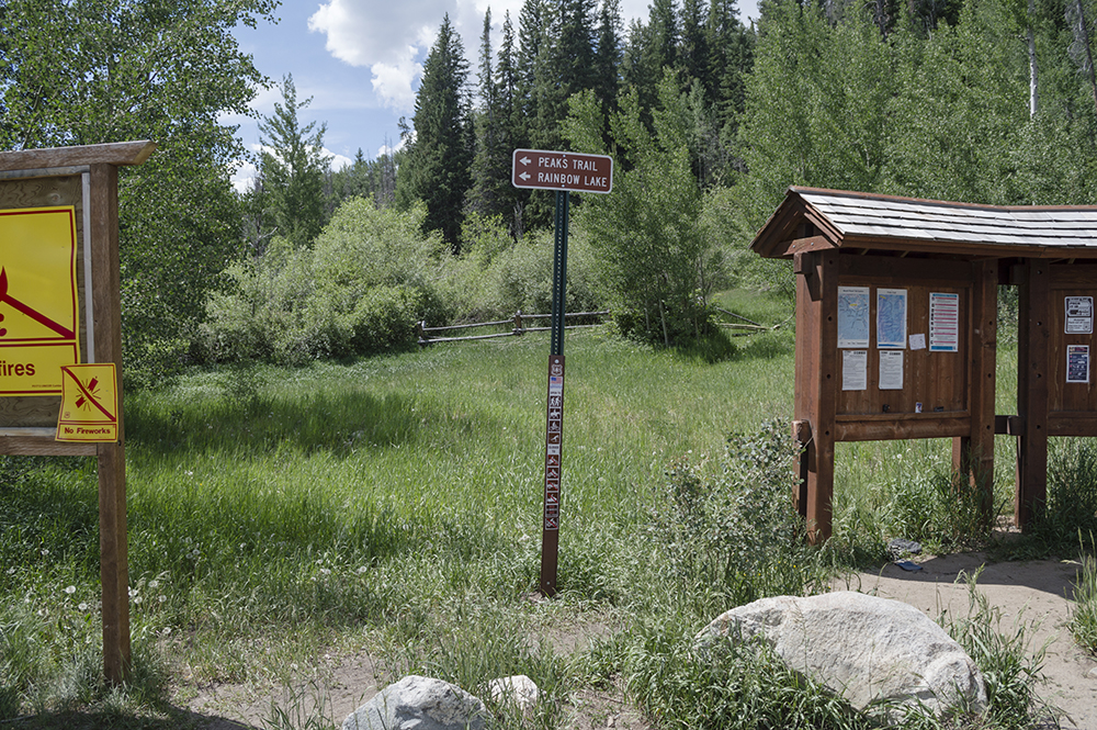
The trail starts from a dirt parking lot and is well marked with signs. The trailhead is the same as that for the Peaks Trail.


The trail crosses shallow stream areas and runs along the stream in places. There is a good amount of shade along the way too.


The lake itself has a couple easily accessible banks: one on the west side and one on the south. The trail wraps part way around the lake and continues on.


This trail allows leashed dogs.

Directions
This trail is located in Frisco, Colorado. To get there, take I-70 to Main St. in Frisco. Take exit 201 and head east on Main Street. Next turn right onto Madison Ave., then turn left onto Granite St. Take the second turn to go right on 2nd Ave. Just before the road curves around, turn right onto Cabin Green. Continue to the dirt parking lot at the end of this road, and you will find the trailhead there. GPS Coordinates: N39 34.139 W106 05.984