February 02, 2019

Big Springs

The Trail
There are a number of trail options starting from this trailhead. Hiking to Big Springs gives your hike a nice end point after a fairly short, moderate trail. Going along the most direct route, shown in green below, the trail is only 1.9 miles long (one way) with a 855 foot elevation change. Alternatively, you can head out on the trail to the east of the parking area. In about a third of a mile after heading up a hillside, hikers will come to a large meadow. This trail crosses the meadow, loops around, and comes to a split with an option to turn off with a possible route from there to Big Springs. Alternatively, by keeping north, the trail will loop around back to the main trail to Big Springs with some spectacular views along the way. The loop (as shown in blue) is about 2.7 miles long with a 530 foot elevation change.


Topographical Map - green=Big Springs Trail; blue=Loop

Graph of Elevation for Big Spring Trail

Graph of Elevation for Loop

Trail in Google Earth

Both of these trails are great during the winter with relatively low avalanche danger. When there is a good snowfall, this trail is an excellent snowshoeing trail.

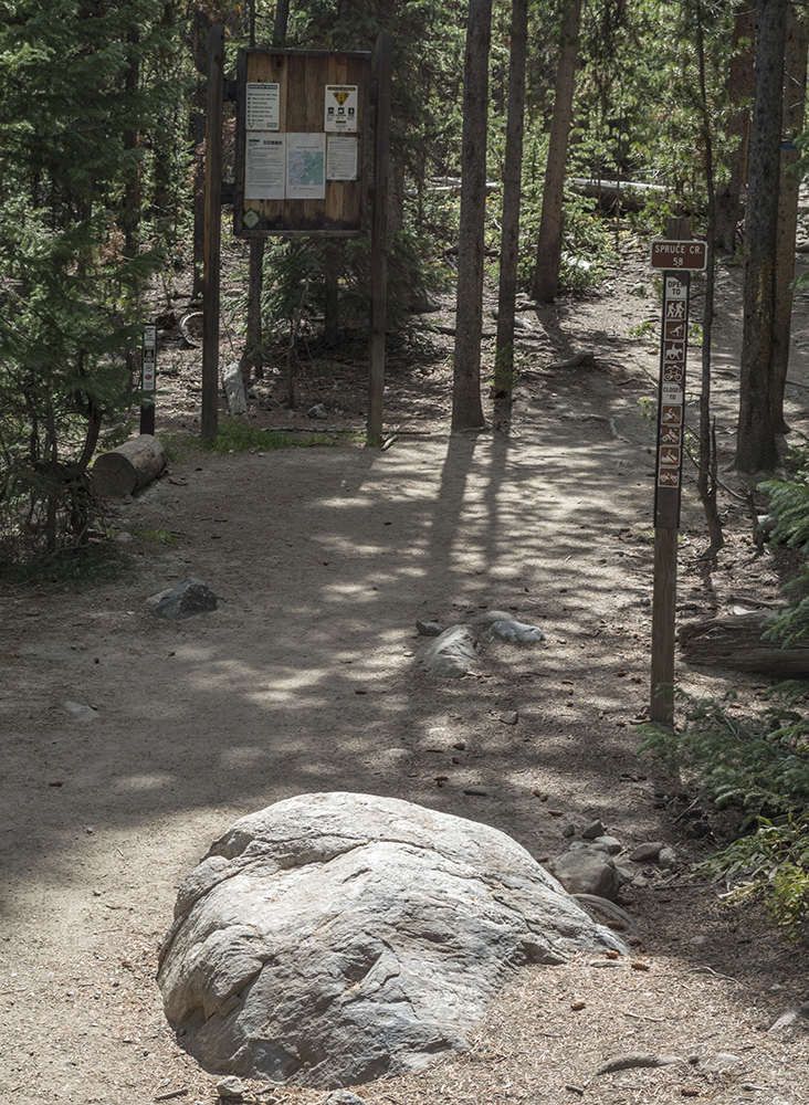
Trailhead for Big Springs Trail


The Big Springs Trail follows the creek much of the way. There are a number turn offs, almost all of which just loop back to the same main trail to Big Springs. Some signs along the way help as well. The last sign we saw before the springs was a split between the horse parking area and the way to the Springs.


Last sign before reaching the Springs

The Springs are not particularly easy to spot in the winter, but they are easy enough to see during other times of year. If you continue along the trail passed the springs, you will be on the Cascade Saddle Trail. The trail shown in the maps above actually continue just passed the spring.

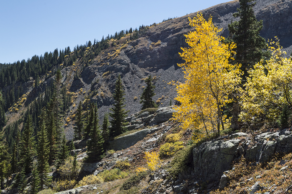
Those taking the loop trail will experience a fantastic tromp through an open meadow at the top of the first climb.


Meadow

The trail curves back after the meadow before heading in a southwest direction and descending toward the creek. The views right before this descent are fantastic.


These trails are open to dogs and livestock. Restrooms are available near the trailhead, but may be closed during winter.

Directions
This trail is located in Utah County. To get to the trail, take exit 272 off of I-15 for 800 North in Orem. Head east along 800 North until the road splits. Take the left fork to head up Provo Canyon. Continue up the canyon for about 5.8 miles, and then turn right onto South Fork Road (toward Vivian park). Drive up South Fork Road for about 3.3 miles, then turn right onto Spring Hollow Road. You will find yourself in a park. If you drive up to the end of this road past the restrooms, there will be a large parking area. The trail starts along the west side of this lot. GPS Coordinates: N40 19.921 W111 31.472

September 21, 2018

McCullough Gulch Trail to Upper Blue Reservoir

The Trail
This trail moderate trail is roughly 1.8 miles one way with a roughly 1,100 foot elevation gain to reach Upper Blue Reservior from the parking area. Unfortunately, we forgot to bring the GPS with us on this hike, so we don't have the information from that to post here. However, you can find some trail maps here, here, and here.

Cars can't actually park near the original trailhead. For this hike, you have to park along the dirt road at a fork and start hiking from there. Hike up the left fork, and soon you will arrive at a gate. Then continue past the gate for a ways and you will come to the original trailhead.


After reaching the trailhead hikers are in for some steeper climbing. The grade of this trail is very similar to that of the Mohawk Lake Trail. The trail crosses a bridge very near the trailhead and goes past an old mining shack. It then continues up the north wall of the valley with the creek rushing down the the ravine to the side of the trail.


Old Mining Shack


Very roughly about 1.5 miles from the parking area, you will reach a split in the trail that allows you to head over to see White Falls.

White Falls

From there it is a short but somewhat steep climb to Upper Blue Reservoir. An unofficial trail continues along the north side of this long mountain lake and then climbs steeply to an open alpine tundra area where hikers can continue on to find a few more lakes if desired. However, we only made it to the far end of Upper Blue Reservoir before we had to head back.

Upper Blue Reservoir.


Directions
This trail is located in Colorado near Breckenridge. To get there from Breckenridge, take Highway 9 south to Blue Lakes Rd. and turn right. Continue past the Quandary Peak parking area to McCullough Gulch Rd. and turn right again. Continue about 1.6 miles up this dirt road to the fork, at about N39 23.911 W106 04.153. There is a sign here explaining that there is no parking beyond that point. Park along this road and walk up the left fork to the trailhead. The actual trailhead is at N39 24.059 W106 04.757.

September 20, 2018

Mohawk Lake

The Trail
This trail is a moderate to difficult 4 or more miles long (one way) if you follow the same path we did - taking the side trails to Mayflower Lake and the falls and stop at tiny lake right above Mohawk Lake. Doing this will give result in a 1890 foot elevation change. If you bypass these side trails and stop as soon as you reach Mohawk Lake, the trail is 3.5 miles long (one way). If you climb the hill by Mohawk Lake for additional views of it and arrive at the small lake right above it, as shown and included in the information below, it adds an additional 0.3 mile to the trail.


Topographical Map

Additionally, there are three other mountain lakes that hikers can continue to after the tiny lake we stopped at. There is less elevation change to get to these than there is to reach Mohawk Lake. This zoomed out version of the trail shows the location of these additional lakes.

Zoomed Out Topographical Maps

Zoomed In Detail Topographical Map (red section to Mayflower Lake;
green section to viewpoint for Continental Falls)

Graph of Elevation - including side trips to falls and Mayflower Lake

Trail in Google Earth

The trail starts at the Spruce Creek Trailhead. This section of trail is easy to follow and is marked by a series of blue diamonds on the trees alongside it. This section also has the least elevation gain to it.

Trailhead Sign


1.6 miles up this trail hikers will come to a pond with a nice view of the mountains the trail heads toward in the background.


At 2.1 miles up the trail there is a dam and the trail meets up with a dirt road. For those with a high clearance 4WD vehicle, you can drive up to this point by continuing up the rough dirt road at the trailhead and start from here, cutting the hike much shorter.


This is also the point where the trail starts climbing a bit more. Continuing 0.3 mile from the dam will bring you to a turn off for Mayflower Lake (shown in red on the topographical maps above). This lake is about 0.15 mile off the main trail.

Mayflower Lake

A Gray Jay at Mayflower Lake

Along the trail to Mayflower Lake and over the next bit of the trail after that to Mohawk Lake, there are many remnants of log cabins.


About two tenths of a mile after the Mayflower Lake turnoff, the trail reaches a group of old cabins, including one that is in good enough shape to act as a storm shelter. There is a turn off here heading north a short distance for a nice view of the Continental Falls (shown in green in the topographical maps above).


Continental Falls

Continental Falls

After the falls, the trail splits off in many different paths. They all seem to lead to the same place, but if you follow the falls up, you will come to more mining equipment and have some additional views of the falls. Please be cautious around the old mining operation and mine shaft. The upward climb here continues to get steeper.


Mining Cable


Continental Falls


As you continue to climb, there are also some nice views looking down at the valley.


Lower Mohawk Lake is about a half mile from the turn off for the falls viewpoint and from where the cabins are, and about 3.1 miles from the trailhead. The trail levels out some along this section by the lake.

Lower Mohawk Lake


Old mining cart by the lake

After the lower lake, the trail picks up a fairly stiff climb to the upper lake. In another four tenths of a mile, you will be on the shores of this pristine mountain lake.

Looking down at Lower Mohawk Lake from the trail to the upper lake

Mohawk Lake


Climbing to the top of the rocks just south the the trail will give you a view of both Mohawk and Lower Mohawk Lakes.


While many people stop at Mohawk Lake, an unofficial trail actually continues along the north wall of the lake to several additional lakes in this valley. This trail also offers some nice additional views of Mohawk Lake.
 
Mohawk Lake from the trail to the north of it


Just up over the ridge of from Mohawk Lake (about 0.3 mile beyond where the trail first reaches Mohawk Lake) is a clear water pond.

Pond after Mohawk Lake


We didn't have time to go further than this, but continuing along this path with bring you to three additional lakes: one at 3.9 miles up, 4.25 miles up, and 4.55 miles up the trail. The the path to these requires minimal climbing to reach them.

Horses and leashed dogs are permitted on this trail. There are no restroom facilities available at the trailhead or along the trail.

Directions
This trail is located in Colorado near Breckenridge. To get there from Breckenridge, take Highway 9 south to Spruce Creek Rd. Turn right and continue to the parking area at the end of this road. From here you will find the Spruce Creek Trailhead on the east side of this parking area. There is a very rough dirt road that continues at the south end of this parking area. If you have a high clearance 4WD vehicle, you can drive up this road and park closer to the dam, cutting off the first 2.1 miles of this hike. GPS Coordinates: N39 26.234 W106 03.037