 The Trail
The Hidden Valley Trail is a moderate 2.5 mile (one way) trail with an elevation change of 2046 feet. The beginning of this trail follows the Indian Trail heading northwest, so follow the signs for this trail as you start out from the trail head. The Hidden Valley Trail breaks off from it about .6 miles up from the start of the Indian Trail and turns southeast from there. The turn off occurs at a rocky area and is marked by a red arrow that says "Hidden Valley" painted on one of the rocks. The trail also immediately picks up its rate of ascent at this point. The climb remains mostly steady to the end of the trail with occasional short sections that are more level.
On the topographical map below, the red flag marks a slight turn off from the main trail that leads to a rocky view point. The blue flag marks a fire pit.
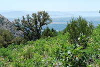
Most of the trail is fairly sun baked as it winds along the exposed face of the mountain while giving hikers nice panoramic views of the valley below. However, a little ways after the rocky view point, the terrain changes and the vegetation becomes more lush. The air becomes noticeably cooler and hikers will cross through a number a mini meadows full of wildflowers before reaching the view point at the end of the trail. The trail concludes with a large rock cairn and a view of Taylor Canyon and the mountains across the way.
 |
| Topographical Map |
 |
| Graph of Elevation |
 |
| Trail in Google Maps |
 |
| Rock Cairn and View at the Trail's End |
 |
| View of the Valley |
 |
| Turn off from Indian Trail onto Hidden Valley Trail |
 |
| Rock Painted with a red arrow to mark the turn off |
 |
| Near the trail's end are a number of little meadows |
Directions
This trail is located in Weber County, Utah. If you are trying to reach the trail head from south of Odgen, take I-15 to Exit 341 for 31st Street in Odgen. Turn right onto 31st Street, continue to Washington Blvd., turn left, and then take the first right onto 30th Street. Continue straight to 1200 E/Harrison Blvd. and turn left. Take a right at 22nd Street and continue up this road until you reach the parking lot at its end. The Indian Trail starts from here and is marked by an informative plaque under a little roofed structure.
If you are coming to the trail from north of Ogden, you can either take Hwy 89 to 12th Street and from there turn right onto Harrison Blvd. and continue to 22nd Street, or you can take I-15 to Exit 343 for 21st Street in Odgen. Turn left to head east along 21st Street to Wall Ave. Turn left on Wall Ave., right onto 20th, and then right onto Harrison Blvd. From there you can turn left onto 22nd Street and continue to the parking lot as explained above.

1 comment:
Just did this trail yesterday for the first time. I'd love to know the story behind the large rock cairns. They remind me of Andy Goldsworthy's work (as seen in the documentary River's and Tides). Happy trails.
Post a Comment