This easy trail is only 1.5 miles long round trip with a 170 foot elevation change. It is set up as a nature trail loop with plaques along the way with descriptions of various plants, natural forces, and similar topics. However, many of the plaques were quite weathered and otherwise damaged when we hiked this trail, making many of them difficult if not impossible to read.
 |
| Topographical Map |
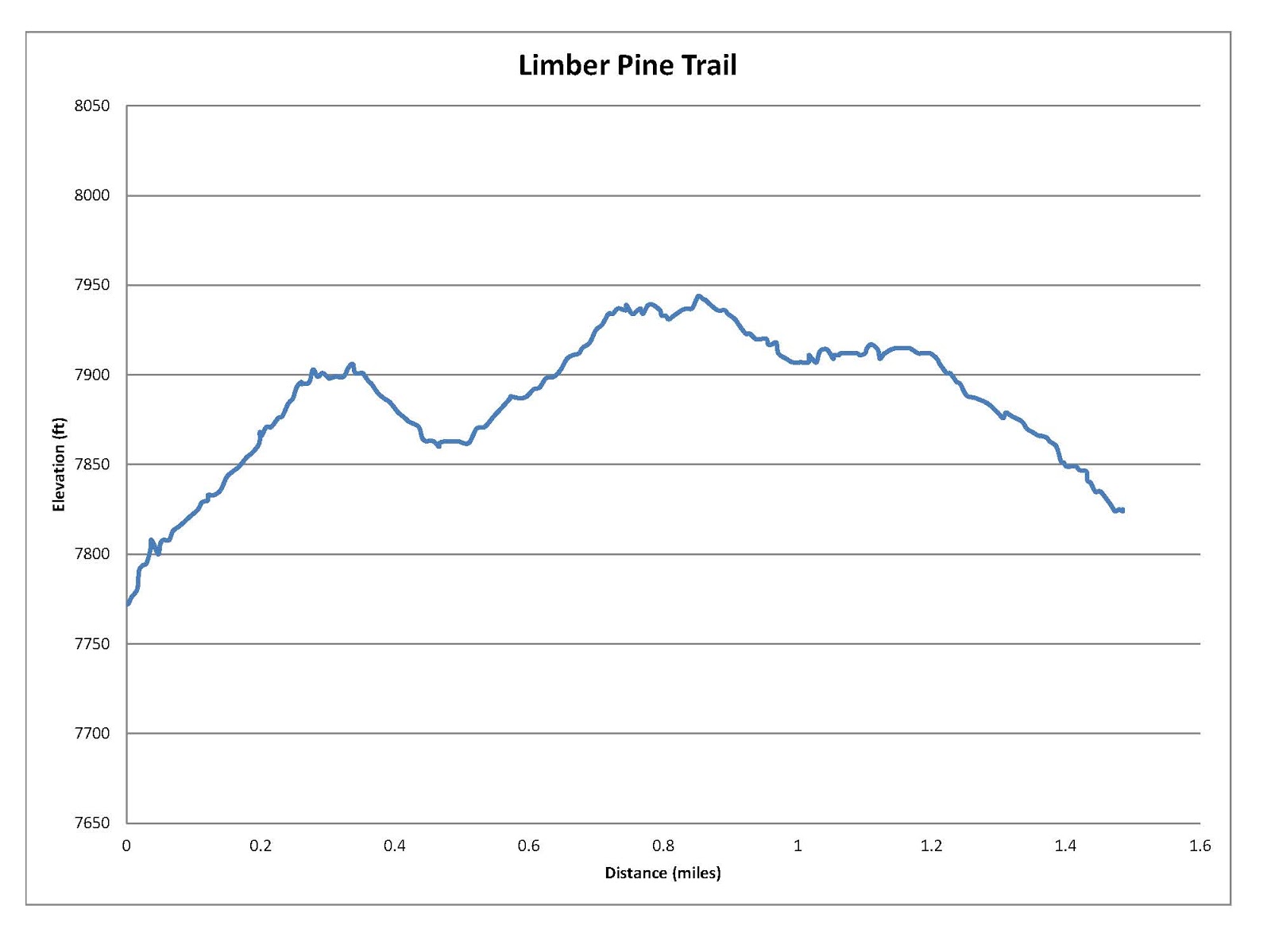 |
| Graph of Elevation |
 |
| Trail in Google Earth |
This trail is perfect for families with young children and others who cannot go far. There are plenty of benches along the way to rest, and the trail doesn't have any steep or otherwise difficult spots. There is an outhouse available at the trailhead.
The trail is named after the old Limber Pine Tree, marked on the topographical map with a little tree. This tree is actually made up of more than one tree that all grew together. There are also some nice views of Bear Lake from the trail.
 |
| View of Bear Lake from the trail |
 |
| Old Limber Pine Tree |

This hike is located toward the Bear Lake side of Logan Canyon in Rich County, Utah. If you are coming from Logan, from Main Street turn east onto 400 North. Continue up 400 N/US-89 for 32-33 miles until you reach the trailhead on your right. There is a parking area here and the trail is marked. If you reach Sunrise Campground, you have gone too far.
If you are coming from Bear Lake, you again just follow US-89 up the canyon to the trailhead. You will arrive just after you pass Sunrise Campground.
No comments:
Post a Comment