This easy trail is 5.25 miles round trip with a 502 foot elevation change if you do the entire thing. Most of the trail just follows the wash. Going just to the arch is 2.2 miles (one way).
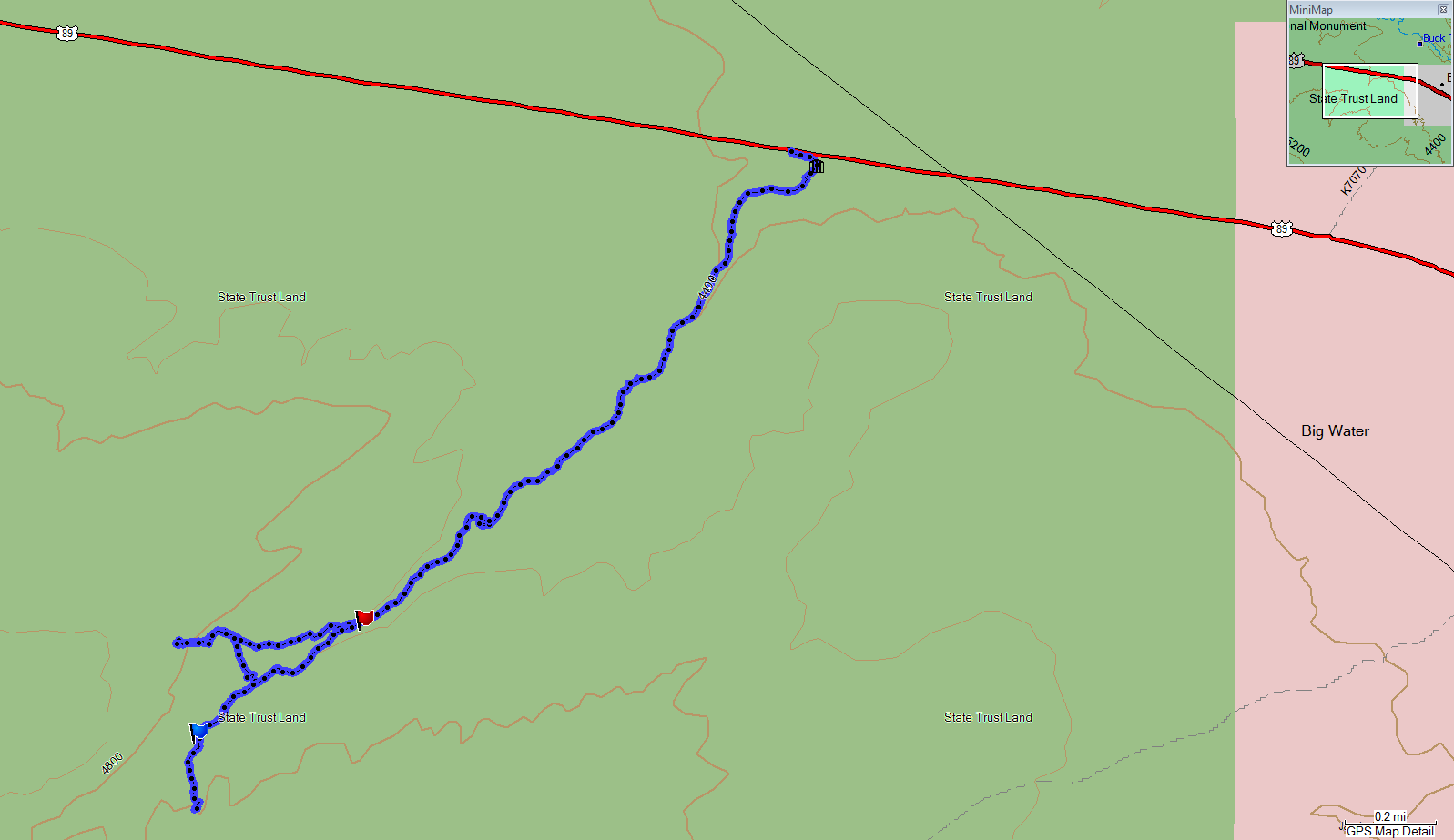 |
| Topographical Map |
 |
| Graph of Elevation (round trip of entire hike) |
 |
| Trail in Google Earth |
To begin the trail, you first following a path down to a gate and enter a wash. As you walk along this wash, your path will alternate between sand and rock.
 |
| Close the gate |


As you continue up the wash, you will come to some pour overs. Some of these can be easily climbed, but the larger ones have paths to the right that go up and around them.


You must follow the wash until you see the arch off to your right (west) and then make your way up to it. After leaving the wash, there is no official trail. There is a good place to make your way out of the wash and head toward the arch about 1.8 miles into the hike (marked by a red flag in the topographical map - N37 04.396 W111 43.346).
 |
| Arch as seen in distance from the wash |
You will have search out a way to get up the rocks right below the arch, but we didn't have any problem finding a doable approach.
 |
| Birthday Arch |

From the arch, you will be able to see a slot canyon on the opposite side of the wash. If you wish you visit it, you can hike back down to the wash and follow it until it crosses another smaller wash (marked by the blue flag in the topographical map - N37 04.180 W111 43.741) stemming from this slot canyon. It is another .7 mile from the arch to this slot canyon.
 |
| The slot canyon is on the left, as seen from the arch |
 |
| Approaching the slot canyon |
The slot canyon is very short and deep. There does not appear to be possibility of continuing up it after you reach the end of this first section, but perhaps if you are an experienced climber you could find a way.


From the slot canyon, you can simply follow the wash back to the trailhead.


This trail is located in Kane County, Utah at mile 9.75 along Hwy 89. It is about 54 miles from Kanab, and 17.3 miles from the Carl Hayden Visitor's Center near Page, Arizona. Finding the trailhead can be a bit challenging since there is nothing to mark the presence of the trail. You must park on the south side of Hwy 89 at mile 9.75 just on the west of a metal railing there. Since there is no parking lot or sign, it is best to just watch the road mile markers.
1 comment:
note the Moki Steps [1] at the entrance of the slot canyon, leading up to some unknown second level.
They are quite difficult to climb without rope.
Also: there's a smaller slot canyon on the left when you exit this one. Nice colors there.
Pascal
[1] https://en.wikipedia.org/wiki/Moki_steps
Post a Comment