This moderate trail is 1.25 miles (one way) with about a 590 foot elevation change. The trail leads to a pleasant grotto area in which a couple small waterfalls drops into a little pool, and water "weeps" off a 30 foot long rock overhang. The water flow is heaviest in the spring; if you go later in the fall as we did, you can expect the waterfalls to be more like small trickles of water. The area is still pleasant to visit though either way.
 |
| Topographical Map |
 |
| Graph of Elevation |
 |
| Trail in Google Earth |
This trail starts at a large gate. This is the same starting point as the Triumph Trail, which turns off soon after the gate (as marked by the hiker symbol in the topographical map above). However, for this trail, hikers continue to follow the dirt road/Bonneville Shoreline Trail for about 0.6 mile to the Steed Creek Trail.
 |
| Trailhead |
 |
| Dirt Road/Bonneville Shoreline Trail |
 |
| Turn off for Steed Creek |
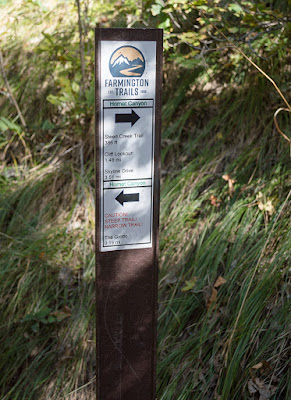
At this point the trail elevation starts to climb. Continue along the trail up the canyon until you reach a sign with a trail split about 0.3 mile later (marked by a green pin on the topographical map above). Notice that both directions will take you to the grotto. However, going right along the Steed Creek path will offer more shade and an easier trail. This is the way we went.
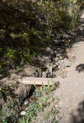
Shortly after that the trail goes across a small plank bridge and past a campsite/campfire spot (marked by a blue flag in the topographical map above). Watch out for poison ivy in this area. And brilliantly colored foliage if you go during the autumn.
It will not be long before the trail splits again. This time it should be obvious that you should stay left to reach the grotto.
As the trail continues, it slants in places and becomes narrow. While we were there, we found someone had placed some ropes along the steeper spots. As always, use caution with ropes placed by others on trails as they can vary greatly in condition and strength.
 |
| A rope along the trail |
 |
| Notice the slant of the trail |
Soon the trail reaches the grotto. The water flow during the fall is minimal, but it is still a pretty spot with mossy rocks, a little pool, and lots of fallen leaves during the autumn.
 |
| "Weeping" Rocks |
 |
| The pool and waterfalls...which are no more than a trickle during the fall |
Directions
This trail is located in Davis County, Utah in Farmington. To get there from north of Farmington, take exit 325 off of I-15 and turn left onto Park Lane. Next, turn right onto Main Street and continue on this road as it curves around. When you reach State Street, turn left and follow this road as it curves around a bend. Keep going until you reach Woodland Dr., then turn left. At the end of Woodland Dr. you will come to a dirt road called Little Valley Road. Drive up to the reservoir and you will find a dirt parking area. Start at the gate across from the dirt parking area with the sign for the Triumph Trail.
If you are coming from the south, take exit 222 off of I-15 and continue along 200 West to 200 South. Turn right onto 200 South, and next turn right onto 200 East. From there, turn left onto Woodland Dr. and continue as outlined above. GPS Coordinates: N40° 58.025' W111° 52.380'


No comments:
Post a Comment